N ~50m until path within re-entrant. Follow that WNW ~500m. Boulders on R. Wall/fence after ~500m. If it runs NW, back SE to corner. Take path NW following re-entrant downhill. Woods on R. Lodge after ~200m. Bearing 270deg for 2-300m until quarry edge. 'Green' path= more up&down & fewer landmarks.
05.03.2026 17:56
👍 1
🔁 0
💬 1
📌 0
Join us in Sheffield this April to celebrate 70 years of the Ecological Genetics Group
Abstract submission is closing soon!
10.02.2026 16:57
👍 3
🔁 4
💬 0
📌 0
I see what you mean - the pic looks like the contours get tighter the further you drop down the slope, but the map shows the opposite. That's got me a bit stumped then! 🤔
08.01.2026 20:02
👍 1
🔁 0
💬 0
📌 0

08.01.2026 14:28
👍 1
🔁 0
💬 1
📌 0
Congrats Dina - very well deserved!
12.12.2025 14:54
👍 0
🔁 0
💬 0
📌 0

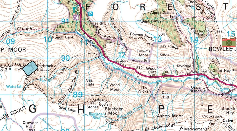
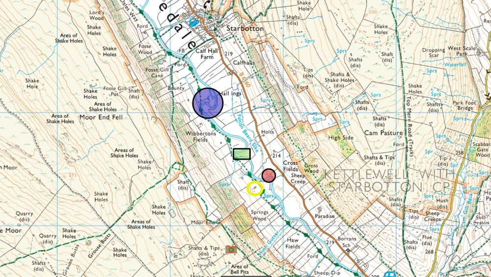
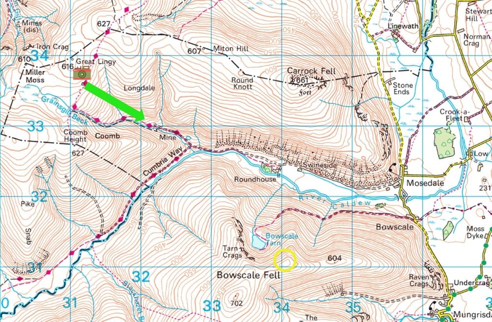
Location is at 310-315m and feature is at ~480-510m
27.11.2025 14:42
👍 3
🔁 0
💬 0
📌 0

20.11.2025 13:50
👍 3
🔁 0
💬 0
📌 0

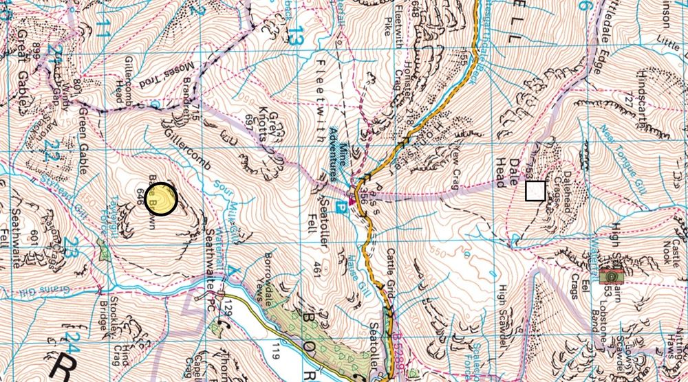
elevation = 650m (or maybe a smidge over)
09.10.2025 13:28
👍 1
🔁 0
💬 0
📌 0
I reached the same conclusion as Rob on this one. Also, ground dropping away on both sides is consistent with A, looking SE. The higher ground beyond the stream feeding the tarn shows steep(ish) rise, then a bit flatter, then steeper again, which is consistent with map.
02.10.2025 15:19
👍 1
🔁 0
💬 0
📌 0

25.09.2025 12:48
👍 1
🔁 0
💬 0
📌 0
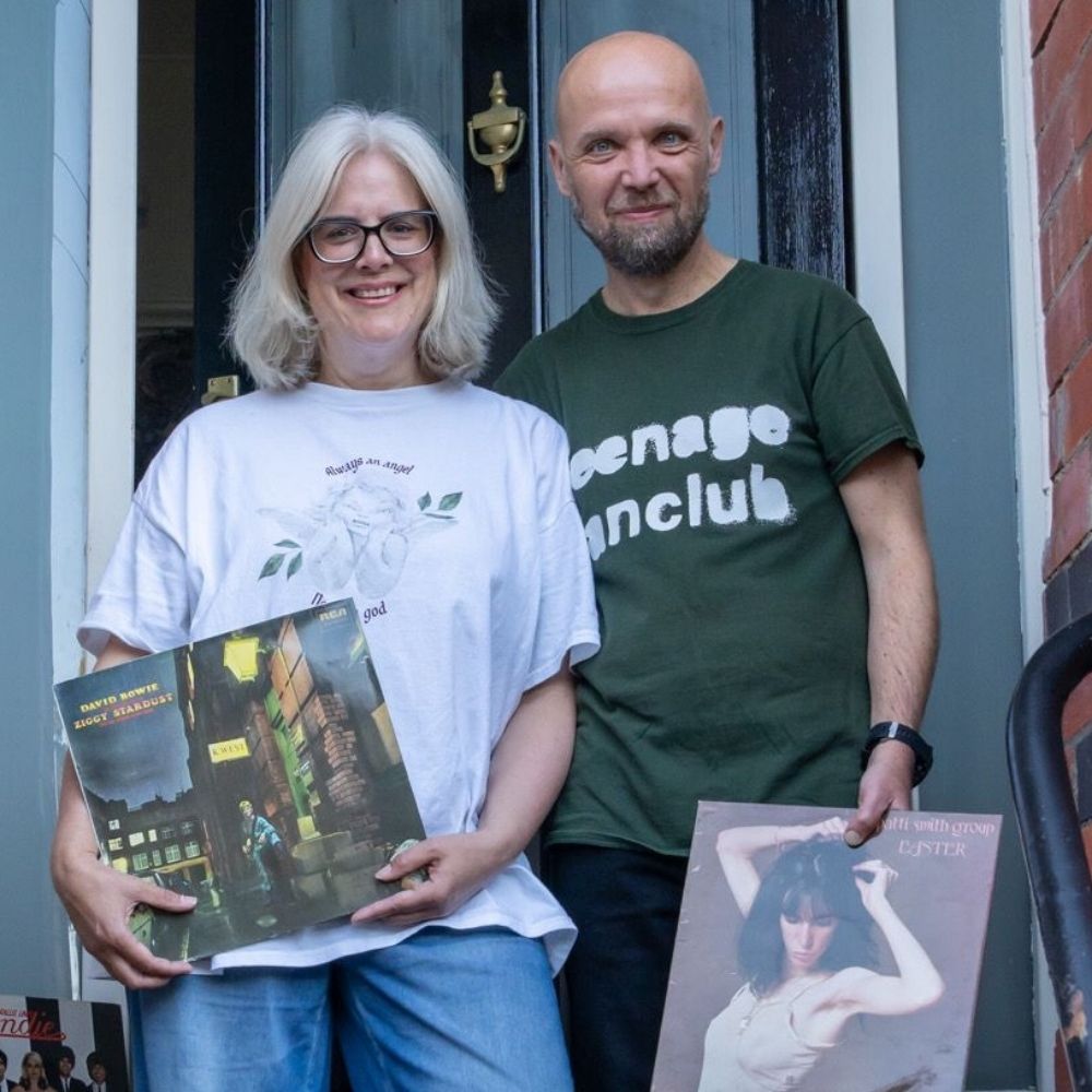
The cover of Zar always makes me think of Stone Roses / Madchester / Spike island era clothing. Not convinced that was the intended look though.
15.09.2025 14:34
👍 2
🔁 0
💬 0
📌 0
17.07.2025 13:27
👍 1
🔁 0
💬 0
📌 0
Height about 650m
03.07.2025 10:33
👍 1
🔁 0
💬 0
📌 0
26.06.2025 14:25
👍 1
🔁 0
💬 1
📌 0
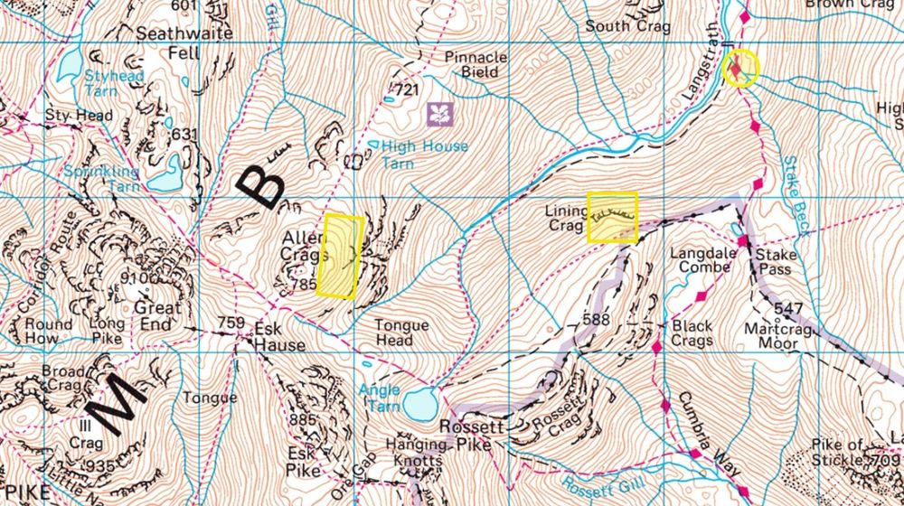
Well I think the vantage point is from just S of bridge marked on the map, and the bridge we can see is not on map. However, I feel like we might be looking at the three re-entrants running S/SE from between Pinnacle Bield and South Crag, and the angle seems wrong, unless foreshortening going on.
12.06.2025 11:23
👍 0
🔁 0
💬 1
📌 0
Not especially confident on this one
12.06.2025 10:37
👍 1
🔁 0
💬 1
📌 0
Same answer /same reasoning as Rob (I hadn't looked at any replies before I reached that conclusion 😀). Know that spot well - my in-laws used to leave 500m NW of the -1 spot height.
05.06.2025 14:33
👍 1
🔁 0
💬 1
📌 0
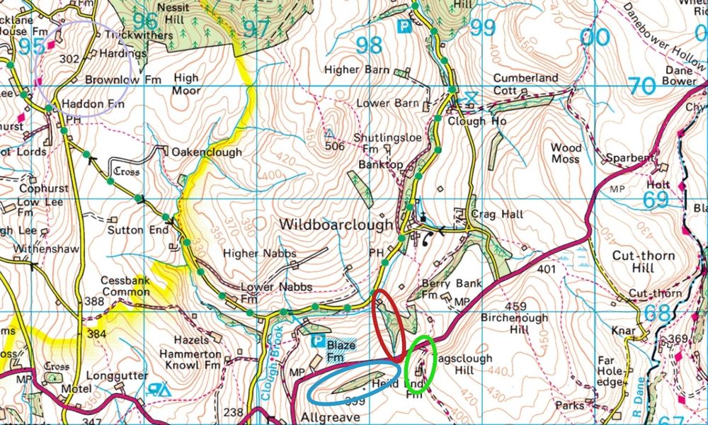
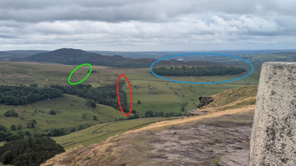
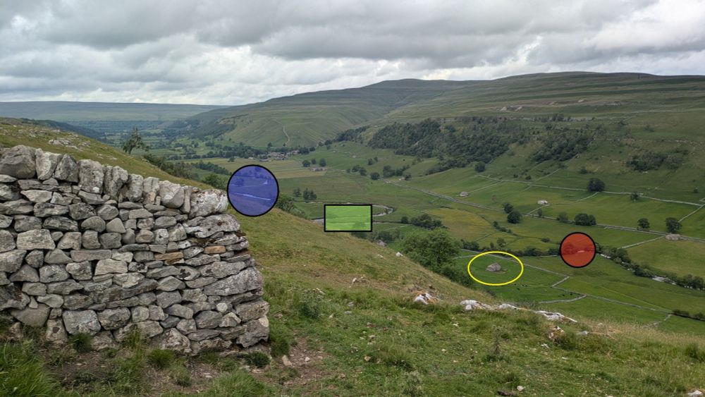
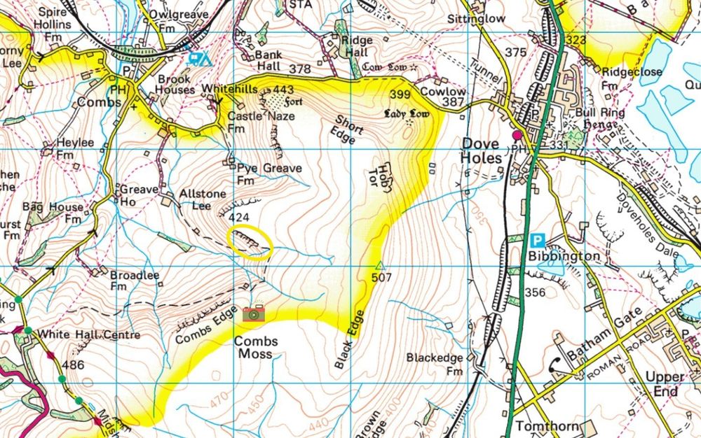
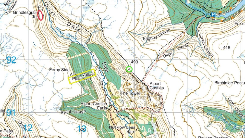
Green circle is kink in track and Heild End farm
29.05.2025 12:36
👍 1
🔁 0
💬 0
📌 0
22.05.2025 13:28
👍 1
🔁 0
💬 0
📌 0
01.05.2025 16:34
👍 1
🔁 0
💬 1
📌 0
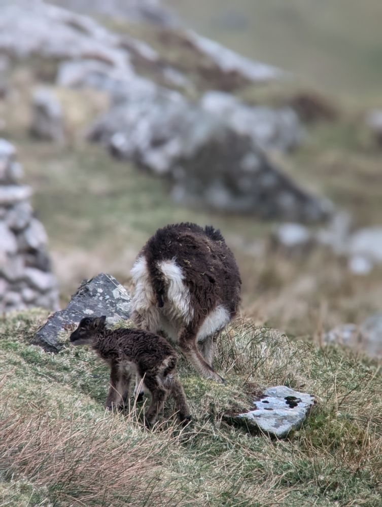
🔭🐑 The first lambs have arrived, and spot on time from consort sightings in November! Soon village bay will be full of skipping lambs and frantic field workers....🏃♀️➡️
15.04.2025 13:32
👍 31
🔁 3
💬 0
📌 0
Sorry to hear this Marty - very much their loss, and best of luck for the future.
15.04.2025 15:58
👍 4
🔁 0
💬 0
📌 0
Good to see a set of questions on long-running biology experiments on #universitychallenge tonight.
14.04.2025 21:17
👍 3
🔁 0
💬 0
📌 0
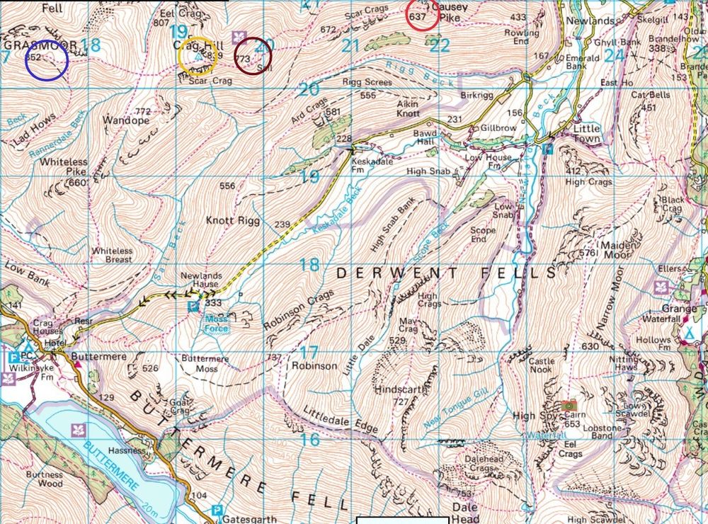
Circle 375m, others 325m
10.04.2025 18:09
👍 1
🔁 0
💬 0
📌 0
ERC-funded PhD position available – Pierre de Villemereuil
👋
Interested in working on the evolution of genetic architecture 🧬 of complex traits using linked-read sequencing of thousands of common lizards 🦎 from a wild population and common garden experiment?
#evolution #genetics
Well, I have a PhD offer for you 👇
devillemereuil.legtux.org/erc-funded-p...
08.04.2025 15:54
👍 37
🔁 52
💬 1
📌 2
I did wonder if it was from nearer the S>N running stream about 1km SW from there.
27.03.2025 18:35
👍 0
🔁 0
💬 1
📌 0
Trickier one today (for me at least!)
27.03.2025 16:25
👍 1
🔁 0
💬 1
📌 0
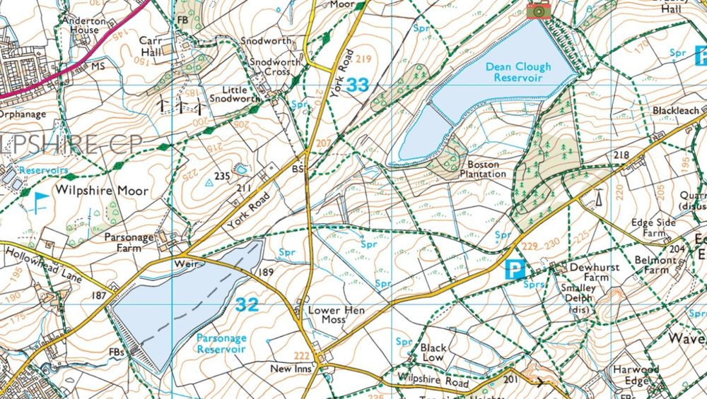
I think here, although perhaps would have expected the map to show a stream entering the reservoir at this point, given what looks like an inflow right in front of you.
20.03.2025 13:40
👍 1
🔁 0
💬 0
📌 0
Elevation ~405m on flatter ground below cliff, ~420m above it
13.03.2025 15:58
👍 1
🔁 0
💬 0
📌 0
13.03.2025 15:57
👍 1
🔁 0
💬 1
📌 0