And that’s a wrap! Every painting I created in 2025. Happy New Year everyone!!!
30.12.2025 16:48
👍 301
🔁 63
💬 8
📌 0
And that’s a wrap! Every painting I created in 2025. Happy New Year everyone!!!
North west Minnesota just south east of crookston


It's always good for ecologists to play with a different ecosystem for a weekend!

One of my favorite stops at the Minnesota state fair is the fish pond at the dnr building.

A Really Very Proud Indeed Martyn standing in front of 2 mantis drawings at the Southern Nature Art Exhibition. The mantises shown are the brown dead leaf mantis and the rainbow coloured iridescent bark mantis.
As a hobby artist who devotes waaay too many hours to an economically-unviable past-time, I have to take my victories where I can. So seeing my drawings in an exhibition and genuinely feeling that they belonged there (quality-wise) was a fantastic experience that I'll treasure for a long time.
Hi #river #ecologists and #geomorphologists, is there an R or python package that can take in DEM or topo data to extract possible historic islands, side channels, and backwaters? Thanks!

Found another cool surface water map for the Upper Mississippi River! This one is from the 1960's!

An illustration of a Rainbow Trout, but instead of the realistic coloring on the body, the colors make a rainbow in honor of Pride month.
I've been camping almost every weekend as of late so haven't been able to post #SundayFishSketch, but here is an edited version of my Rainbow Trout illustration with altered coloring in honor of #PrideMonth.
Recently, all the AAAS Science & Tech Policy Fellows at EPA were terminated from our positions with little notice and for no clear reason. This effectively ended a partnership that had been going since 1980 and which had brought hundreds of scientists to the EPA as fellows, many of whom stayed. 1/7
I'm definitely going to give it a stab in R. Happy to connect if you move forward on it too!

They don't make river plots like this anymore. 🤩
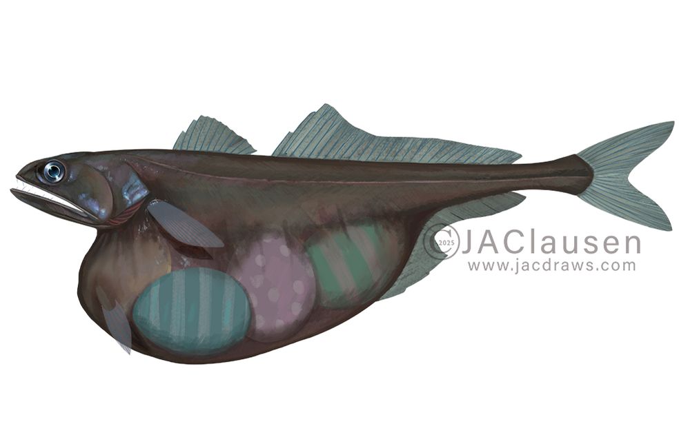
An in progress illustration of a Black Swallower fish. This fish lives in the deep sea and is brown to black in color with a long, thin body. It has a pretty large eye and very large mouth that leads to a stomach that can extend to several times its regular size, sometimes even becoming partly transparent. This allows the fish to eat prey larger than itself. In this illustration, I added some colorful Easter eggs in its stomach to fit with the Sunday Fish Sketch theme.
Have been working on an illustration of Chiasmodon niger and decided to modify it a bit to fit today's #SundayFishSketch theme.
NOAA just announced a long list of datasets that are going away🧪⚒️🌊: www.nesdis.noaa.gov/about/docume...
Download what you need asap and send comments to: ncei.info@noaa.gov

An illustration of an American Paddlefish. The viewer is looking slightly up at the fish as it swims by. The bottom of the water body is full of silt and small stones. The water is a murky turquoise color, and sunlight illuminates the top of the fish.
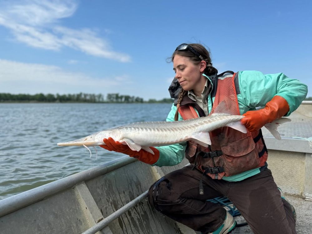
I don't go fishing, but I would love to see an American Paddlefish for today's #SundayFishSketch
#SciArt
I'm so glad to see #sundayfishsketch themes again!
This weekend’s #SundayFishSketch #Fishytheme is for all of us that are very much looking forward to spring and summer angling. Sitting in the boat or on the dock, enjoying nice weather and nature sounds. Let’s see some sketches of fishes you’d like to catch this year (wherever you are)! #sciart 🦑
I spent an embarrassinly long time just trying to get the gdal package updated to the latest version, which the riverrem package needed

Not sure. Just thought I'd take the opportunity to revitalize my Python skills!

There's now a package to make your own river elevation models in python! github.com/OpenTopograp... As a river restoration scientist this is super helpful in identifying the underlying behavior of a river. Below is an example of Pool 1 in the Mississippi River.

1/2) An apology to my #SundayFishSketch community for dropping the ball on #Fishytheme posts and participation. My time has been focused on my first semester teaching as a professor. We also purchased and moved into a new home. To top it off, I have a little fry incoming at the end of September.
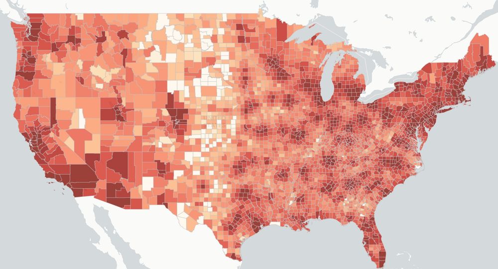
US map via scienceimpacts.org visualization of economic loss due to IDC cuts to 15% as part of Feb 7, 2025 executive order, with shading denoting intensity of cuts.
Working with an interdisciplinary team, we have developed a website to communicate how the White House's proposed cuts to health research would cause losses of $16B and 68,500 jobs.
Find out how your community may be impacted.
Explore more at SCIMaP: scienceimpacts.org
a 🧵
Please share around to support our federal workers!💪


This is how I feel when I start up a new programming language to learn. 🤣

A work in progress illustration of a school of Lookdowns swimming in shallow water. The fish are swimming to the right side of the image, and the water is a turquoise color. The bottom is sandy, and the light shining through the waves refracts chaotically on the sand.
More progress on my Lookdown illustration for today's #SundayFishSketch 🐡

A bird's eye view illustration of five Cownose Rays swimming through shallow, blue-green water.
An illustration of some Cownose Rays
#SciArt

An illustration of a Spotted Gar. The fish is long and thin, with a long, thin nose. The back is a darker olive-brown, and fades to pale cream towards the belly. The fins have a slight orange-red hue to them, and the body of the fish is covered in dark, irregular spots.
I finally finished my Spotted Gar illustration for today's #SundayFishSketch 🐡
Absolutely terrible.
@lizrenner.bsky.social is an amazing scientist, colleague, and friend. SMFH.
The attacks on our science, public lands, and PEOPLE of this country are real. We will ALL be affected. www.keloland.com/keloland-com...
Probationary layoffs hitting USGS, NOAA and NPS soon, per source at DOI

Definitely check out the atlas feature in QGIS to mass produce data driven maps. In my river restoration work I created a template map that compares modern aerial imagery to a historic 1890 ground survey of the Mississippi River but QGIS spits out the comparison at every river mile, all 855! #rivers