
#tornado last night near Bluff City, KS around 11:30pm #kswx
06.03.2026 15:34
👍 65
🔁 15
💬 0
📌 3
#tornado last night near Bluff City, KS around 11:30pm #kswx


Incredible show tonight! Did you see them?
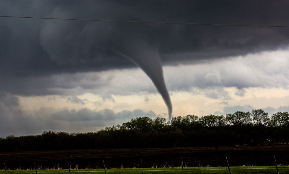
Another tornado from the 4/26/24 outbreak. This was a brief EF-1 nw of Waverly, NE.
Jamaica is about to take a direct hit from 175-200 mph winds. This will last for hours. #melissa


We saw 2 tornadoes Sunday near Arnett, OK! #okwx #tornado

Caught this shelf cloud Sunday in New Madrid, MO. #green #hail #shelfcloud

Waiting for initiation in SE Missouri along I-55. Ingredients are building. A few strong tornadoes are possible today.

SPC has issued a large slight risk area for Sunday March 30th. #spring #severe

Happy Sunday! These will be back soon! #shelfcloud #mothership

SPC has added an area to watch for #severe #weather potential for this coming Friday. Maybe the first chase of 2025.


JANUARY ARTIC BLAST?!?
Couple models showing the potential windchill on January 10th!
This is not a forecast! Just be prepared for the cold in 7-10 days!


Keep an eye on things in the southern US today. All the ingredients are in place for a potential tornado outbreak. We busted south last night and are making our way into the area this morning.

It’s looking more and more like we will see freezing rain Friday night into Saturday. You may want to limit your travel Friday night!

What an amazing sunrise this morning in central Iowa!
Happy thanksgiving!

2024 has been absolutely incredible from every angle. So many experiences I was able to share with my family. Thank you for coming along for the ride! #tornadoes #aurora #eclipse #weather
Great shot!! That was a fun day!

This was an EF-1 that touched down nw of Iowa Falls, IA on 7/28/23.
Thanks everyone for following along! @bsky.app algorithms are clearly better than X! More followers in 30 days than x in well over a year!

Check out this photo from yesterday over tinker AFB in OKC from @aaronsstormshelters
This wasn’t a confirmed tornado on radar but could have been a spin up or just an ominous looking cloud!
Terrible scenes from OKC last night!
www.facebook.com/share/hZMkAr...


SPC has put an ENHANCED risk in place for Wednesday 10/30. A hatched 10 percent area for much of eastern KS. I will be chasing this event with @johnnyraincloudstormchasing

SPC outlook for Wednesday 10/30- Slight risk in place for the possibility of severe weather. This will be the big frontal boundary that will finally make fall arrive! Much cooler temps later in the week.


Tornadoes at sunset! These were from Wiota, IA June 28th, 2024
#iawx #twister #tornado

SPC has portions of Kansas, Missouri, and Iowa under a marginal risk for wind and hail this afternoon into this evening. #iawx #kswx #mowx

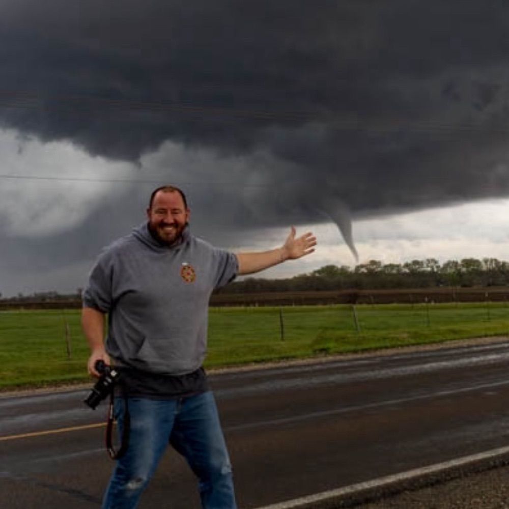
Here is another shot from 4/26/24. This #twister was an EF3 in Lincoln/ Waverly, NE. #tornado #newx #outbreak

Caught this brief tornado with my son on 8/5/24 near St James, MN!
#tornado #mnwx
Hey everyone welcome to the page! You’ll find various weather updates, photos, and videos on my page. Feel free to check out my other socials including Facebook as well!
Thanks! Jeremiah (JP Midwest Storm Chaser)

4/26/24 EF3 near McClelland, IA!
#tornado #iawx
