www.realbloc.com has been redesigned and is now 100% free to use down to the building level detail. Discover unique insights for your neighborhood today!
15.05.2025 17:32
👍 0
🔁 0
💬 0
📌 0
@petercblack
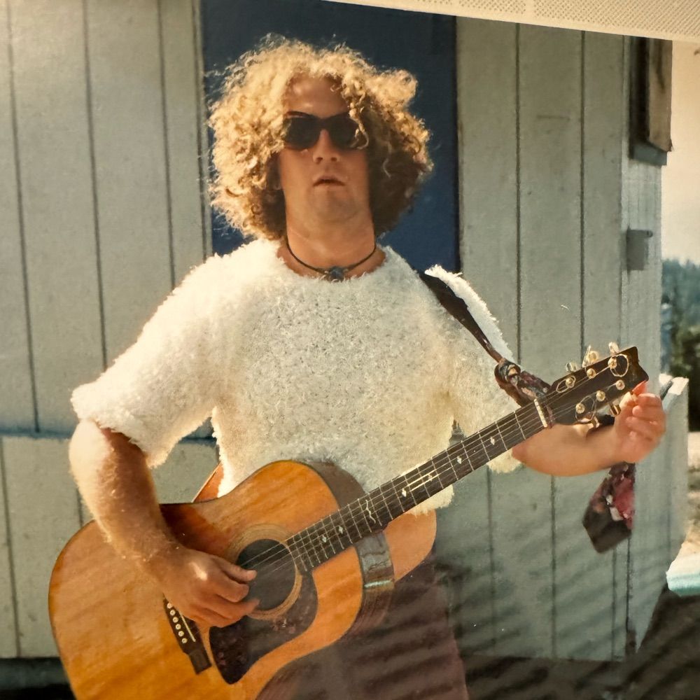
Musician (https://shorturl.at/oUoXC), Soccer Ref, Husband, Dad, game dev, Brother, Geographer, Geospatial Applications and Products, Non fiction reader. I made these sites: www.realbloc.com www.wtfmap.com a daily dot map game www.defensibleapp.com
www.realbloc.com has been redesigned and is now 100% free to use down to the building level detail. Discover unique insights for your neighborhood today!

I've been going back and forth for the all time high score with another www.whereusa.com player named DAW. Bring it DAW
Is intentionally tanking the economy an impeachable offense? Asking for a friend
And the market’s red glare, the 401ks bursting in air…
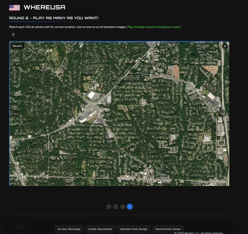
I created a new version of www.whereusa.com that allows users to play infinite number of times. Give it a go!
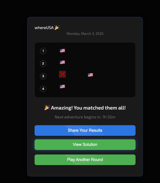
whereUSA.com - Sunday, March 2, 2025
🎉 Matched them all!
1: 🇺🇸
2: 🇺🇸
3: 🇺🇸
4: 🇺🇸
www.whereUSA.com
Happy Friday! I've just released www.whereusa.com a daily air photo game that challenges you to think about geography. You are presented with 4 air photos and 4 place names, and it's your job to match the pic with the place name. Simple! Or is it...
I thought about a use case for that. What would be a helpful example?
Thank you Ryan!
I have also created an interactive portfolio: www.realbloc.com/portfolio.html
If you are interested in my services, please contact me!
I've made several updates to www.defensibleapp.com. Have a look around!
Maybe a little high for the lidar?
Friday nite lights: great night for some oblique aerial photography
I think it gives the dubs, and any other team, license to move their best player for something different.
I’m in the middle of a rather large refactor of www.defensibleapp.com. I’m updating the structure level risk data with 2024 sources, and pulling in other data that have become table stakes. What else would you like to see in the app? If it’s sensible I’ll do it.
Buddy smh
Dang
WTF Map Game - Friday, January 24, 2025
🗺️ Keep exploring!
💩
💩 💩
www.wtfmap.com
If you see this post, quote with a bridge from your gallery
I’m all for the bay of awesome sauce
He’ll be 37 in march. If he wants to chase another chip, help him.
I encourage everyone to at least check and see what their wildfire risk is, whether it’s on this site or something else. Know the risk. Plan appropriately.
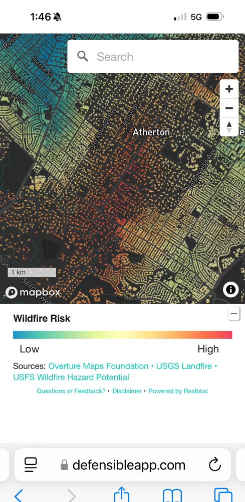
Atherton is really highly at risk for wildfire. Do folks there know this?

Preparing a go bag for a wildfire emergency.
www.cbsnews.com/losangeles/n...
It’s an incredibly important app that should be on everyone’s phone who live in fire country. But I have to imagine these simple fixes will make a world of difference in making the maps usable for the average person
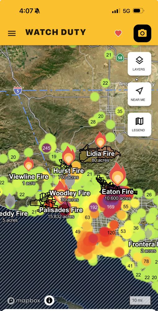
I love watch duty but I believe they need to reconsider some cartography choices because it muddies up what should be a cleaner UI
- the purple air points/smudges should be an optional toggle able layer
-why is the ocean hatched?
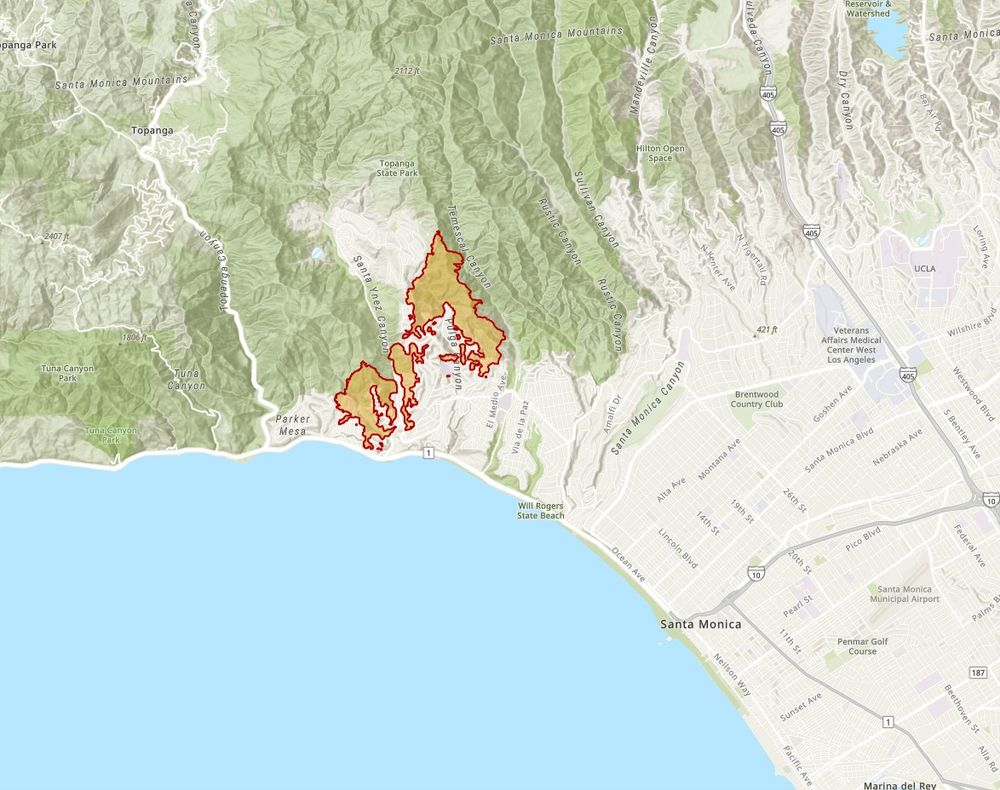
via California Firis, the latest perimeter for the Palisades fire
Truth
Snow looks good on US
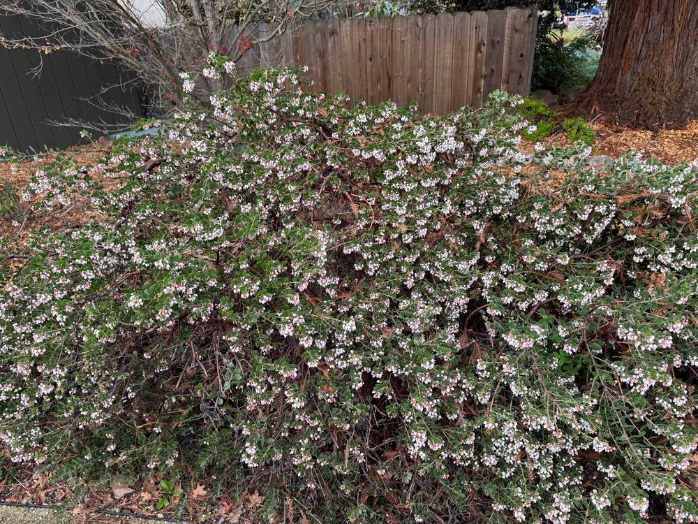
Peak Manzanita
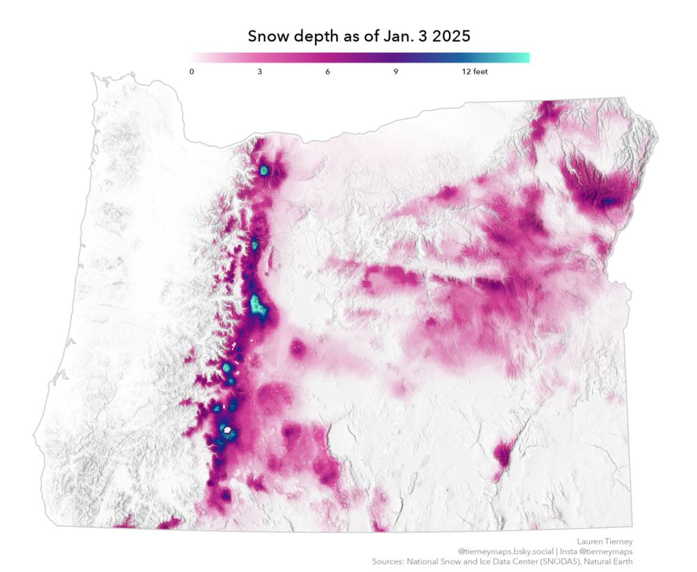
Map of snow depth across Oregon. Snow depth is higher in the mountains and in the eastern half of the state.
Snow depth across Oregon, as of today.
#mapping #cartography

