And this is exactly why we need global ground motion services. Large, slow-moving slope systems don’t respect borders — and millimetre-scale deformation beneath real communities demands systematic, open, long-term #InSAR monitoring at continental to global scale. #DRR
02.03.2026 15:15
👍 1
🔁 0
💬 0
📌 0
The Leo Pargil DSGSD isn’t just remote alpine terrain. ~1,000+ people live within or directly on the deforming slope system (Nako, Malling, Liyo), and NH-505 crosses it. Millimetres per year — beneath real villages and a critical Himalayan lifeline.
02.03.2026 15:15
👍 0
🔁 0
💬 1
📌 0

Fig. 9. Conceptual and geological framework relevant to slope deformation at the Leo Pargil Dome. (a) Conceptual scheme illustrating gravity-driven zones of extension and compression on a steep ridge, after Savage and Varnes (1987). (b) Simplified geological cross-section and block diagram of the Leo Pargil Dome, showing the regional structural architecture and extensional setting, after Thiede et al. (2006). (c) Northwest-oriented geological cross-section across the western flank of the Leo Pargil Dome at the latitude of Nako village, highlighting major lithological units and extensional structures, after Langille et al. (2012).

Fig. 6. Decomposition of LOS velocities into 2D displacement rates using an extended colour scale. (a) East–west horizontal and (b) vertical velocity fields inverted from paired Sentinel-1 ascending and descending LOS velocity fields (2018–2023).

Fig. 5. Decomposition of LOS velocities into 2D displacement rates using a narrow colour scale. (a) East–west horizontal and (b) vertical velocity fields inverted from paired Sentinel-1 ascending and descending LOS velocity fields (2018–2023).
This is a big one, literally. New paper out in Geomorphology: we use multi-geometry Sentinel-1 InSAR to unravel the internal kinematic segmentation of a 55 km² deep-seated landslide in the NW Himalaya. www.sciencedirect.com/science/arti... #DRR #InSAR #Sentinel-1 #landslide
02.03.2026 15:15
👍 4
🔁 0
💬 1
📌 0
Where?
16.02.2026 21:22
👍 1
🔁 0
💬 1
📌 0
EGMS
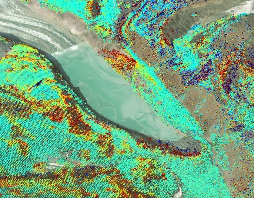
Not quite. The red dots in your image are from below the town. If you enable Calibrated layers (higher resolution) and zoom in on the area that has failed, there is no significant difference from the stable area. Important to turn the map in 3D to see. egms.land.copernicus.eu#llh=14.38034...,
09.02.2026 11:42
👍 1
🔁 0
💬 1
📌 0


Hey #inuitart experts. I purchased this qiviut wall hanging in Yellowknife in 1993. It used to have a tag on it with the name of the artist, as well as the community she came from, but it is lost. I would very much like to know more about the artist. Does anyone recognise the signature or the style?
04.01.2026 17:51
👍 2
🔁 0
💬 0
📌 0
See you there.
23.11.2025 22:38
👍 0
🔁 0
💬 0
📌 0
⏰ Deadline extended!
The #ISPRS2026 abstract submission deadline is now 17 November.
Check out our Special Session on Cooperation on Ground Motion Monitoring for DRR & Resilience 👇
www.isprs2026toronto.com/special-sess...
#InSAR #DisasterRiskReduction #ISPRS2026
04.11.2025 08:15
👍 3
🔁 0
💬 0
📌 0
Pretty low. Before the originally planned launch date for 1C, there were discussions about a possible 3 satellite constellation for some period. But at that time, both 1A and 1B were very healthy. The situation is quite different today as 1A is on it's last legs.
29.10.2025 11:14
👍 1
🔁 0
💬 0
📌 0

Full of leading scientific institutions, Trondheim could be a natural laboratory for world-class collective transport.
But progress remains constrained by car-centric policies that support electried, privately-owned cars. The thinking: Green cars = Green economic growth. A cosmetic solution.
15.10.2025 06:58
👍 4
🔁 1
💬 0
📌 0
On this International Day for Disaster Risk Reduction, iddrr.undrr.org, I'd like to call attention once again to our idea of an InSAR-based global ground motion service, and our upcoming special session at ISPRS in Toronto. Abstract deadline is Nov 3. www.isprs2026toronto.com/special-sess...
13.10.2025 14:08
👍 0
🔁 1
💬 0
📌 0
22:03 CET (10:03 PM)
06.10.2025 13:40
👍 0
🔁 0
💬 0
📌 0
Absolutely. Hydropower dams worldwide face similar risks—yet most have no satellite-based monitoring at all. Time to change that. Join us at #ISPRS2026 Toronto and help make the case for global ground motion services. bsky.app/profile/john...
26.09.2025 07:02
👍 2
🔁 0
💬 1
📌 0
We are very much looking forward to global L-band NISAR data! But this is definitely not new! We have been doing this for several decades.
24.09.2025 07:45
👍 2
🔁 0
💬 1
📌 0
We had tremendous response to our initiative for a Global Ground Motion Service at #GP2025 this spring.
The technology is proven. The data exists. Let's go global.
x.com/NorwayInGene...
22.09.2025 11:51
👍 1
🔁 0
💬 0
📌 0
From earlier this year at #GP2025: x.com/NorwayInGene...
22.09.2025 11:46
👍 1
🔁 0
💬 0
📌 0
That’s what our Special Session at #ISPRS2026 Toronto is about. Topics include:
· InSAR in DRR strategies
· Open services
· Multi-stakeholder cooperation
· Extending services to underserved regions
22.09.2025 11:39
👍 1
🔁 0
💬 2
📌 0
The tools exist to build a Global Ground Motion Service. Open #SAR missions like #Copernicus #Sentinel-1 and NASA/ISRO’s #NISAR can already track vast areas. What’s missing is cooperation.
22.09.2025 11:39
👍 1
🔁 0
💬 1
📌 0

European Ground Motion Service map of the Guadalentín Valley, Spain. InSAR deformation points show a gradient from green (stable) to red (strong subsidence), revealing land sinking caused by intensive groundwater extraction in agricultural areas.
Groundwater & infrastructure: Subsidence in California or Spain’s Guadalentín Valley shows how over-extraction damages farmland, cities, and flood defences. InSAR makes the invisible visible.
22.09.2025 11:39
👍 1
🔁 0
💬 1
📌 0

Satellite image of a large tailings dam in Uzbekistan. InSAR deformation data shows a red band around the dam walls, indicating significant ground movement.
Mining & tailings dams: InSAR highlights deformation at sites like Uzbekistan. Failures can release toxins, devastate ecosystems, and take lives. Many risks are preventable if we act early.
22.09.2025 11:39
👍 1
🔁 0
💬 1
📌 0
Satellite view of South Lhonak Lake in the Himalayas, overlaid with InSAR deformation data. Red and orange zones along the moraine show precursory ground movement before the catastrophic 2023 glacial lake outburst flood.
Glacial Lake Outburst Floods (GLOFs): InSAR detected precursory deformation at South Lhonak Lake before its catastrophic 2023 flood. These events cascade far downstream. (www.science.org/doi/10.1126/...)
22.09.2025 11:39
👍 1
🔁 0
💬 1
📌 0

Satellite images of steep mountain slopes in Argentina. Top row shows natural-colour terrain. Bottom row overlays InSAR ground deformation data, with red areas marking active slope movement, highlighting large, slow-moving landslides across the region.
Here are three examples from San Juan Province, Argentina, highlighted by #InSAR. These slow-moving landslides affect large, high-relief mountain slopes and demonstrate the value of regional-scale monitoring for identifying potential geohazards in remote areas where on-the-ground access is limited.
22.09.2025 11:39
👍 2
🔁 0
💬 1
📌 0
But what about the rest of the world? Most regions still don’t have access to this kind of critical information. Too often, where hazards are highest, monitoring is weakest. That gap must close.
22.09.2025 11:39
👍 1
🔁 0
💬 1
📌 0

Image from InSAR Norway showing a fjord with mountainsides. The mountainsides are coloured red where unstable slopes are moving.
#InSAR is a proven technology for disaster risk reduction—and it scales. Examples like InSAR Norway insar.ngu.no and the European Ground Motion Service already provide billions of open measurements.
22.09.2025 11:39
👍 1
🔁 2
💬 1
📌 0

Partial globe showing coverage by the European Ground Motion Service, showing dense deformation measurements. Highlights how some regions have access to life-saving data, while most of the world does not.
Why are we organizing this? To push forward a new initiative: making life-saving ground motion data available worldwide, especially where it’s needed most.
22.09.2025 11:39
👍 2
🔁 0
💬 1
📌 1

ISPRS 2026 Special Sessions
Discover ISPRS 2026 Special Sessions – expert-led, in-depth discussions on emerging topics in photogrammetry, remote sensing, and spatial information sciences.
I’d like to call your attention to a Special Session Drew Rotheram-Clarke (GSC) and I are co-chairing at #ISPRS2026 Toronto:
👉 “Cooperation on Ground Motion Monitoring for Disaster Risk Reduction and Resilience.”
👉 www.isprs2026toronto.com/special-sess...
#DRR #InSAR
22.09.2025 11:39
👍 3
🔁 1
💬 1
📌 3
Fantastic!
16.08.2025 07:04
👍 1
🔁 0
💬 0
📌 0


