GraalVM compiles your applications ahead of time into native executables that start instantly, scale fast, and use fewer resources 🚀
GPGRS
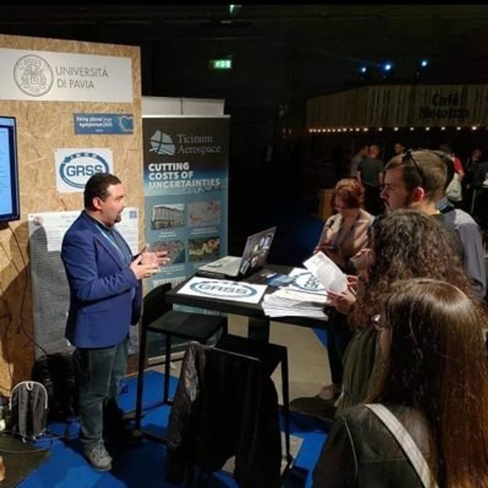
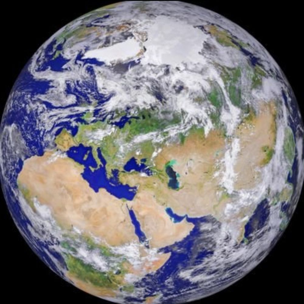
› Earth Observation & Spatial Science
╔═════════════╗
║● GIS G #GIS
║● Photogrammetry P #Photogrammetry
║● Geodesy G #Geodesy
║● Remote Sensing RS #RemoteSensing
╚═════════════╝
ESA SNAP Toolbox for visualising and processing Earth Observation data
https://step.esa.int/
#Satellites #Science #SeaIce #ExtremeLatitudes.
Remote Sensing of Polar Regions at University of Bremen,
Institute of Environmental Physics (IUP).
https://seaice.uni-bremen.de
Proudly serving the people of New Jersey in the U.S. Senate.
Antarctic scientist @Geoscience Australia interested in earth observations, marine science and understanding change. Bike rider, mum, outdoor enthusiast.
Earth observation scientist 🛰️ Using open data, programming, ML and GIS to support a sustainable future. Loves a cheeky field trip 🚗☀️🌳🌊
Earth observation scientist, passionate advocate for documentation and process (someone has to be), palaeoclimatologist, python coder and lover of animals, particularly a snuggly pugX who sleeps at my feet while I work.
@esa.int #EarthObservation: Taking the pulse of our planet from space.
Please see our Privacy Notice: http://esa.int/connectwithus
We share pictures and news on our planet as seen from space.
Science that matters 🔬💧 The official account of the Swiss Federal Institute of Aquatic Science and Technology Eawag. www.eawag.ch
PhD Student at University of Washington. Soil scientist using remote sensing for forest and wetland carbon cycling
The Director General of the European Space Agency
Remote Sensing Scientist @ Swiss Federal Institute of Aquatic Science and Technology (Eawag) 🇨🇭 @eawag.bsky.social
About me: https://mowerther.carrd.co/
We're the European Space Agency, keeping you posted on European space activities.
Please see our Privacy Notice: https://esa.int/connectwithus
Applied Remote Sensing Lab in the Department of Geography at McGill University led by Dr. Margaret Kalacska
We are the Professorship of Earth Observation for Ecosystem Management at the Technical University of Munich!
Our focus is on applying cutting edge remote sensing technologies to study forest ecosystems.
https://www.lss.ls.tum.de/en/eoem/
Marine Scientist, Earth Observation & GIS Scientist, Lagoons, Lakes, Climate Change, Environmental Change, Water Quality, System Vulnerability Hotspots
Environmental data and Earth Observation - tailor-made software solutions, information products and expert advice
https://www.brockmann-consult.de
PhD student, Earth and Marine Sciences.
Global Hydrology Lab at University of North Carolina at Chapel Hill #EarthObservation
Even if a Blue Sky is not necessary for SAR imaging , it is better for mind.
at CNES (French Space Agency)
Radar processing dept
Insar / Altimetry / Earth Observation
Views are my own.
Creator of #AwesomeSpectralIndices | #eemont | #spectral
PhD Student @RSC4Earth
#EarthEngine GDE
Monitoring the environment with satellites, drones, and other remote sensors at the gov.
Interested in biodiversity & climate policy and conservation action. Based in the highly urbanized region of Flanders, Belgium
#remotesensing #earthobservation
Founder of ConnectAID www.connectaid.org
Director of External Relations at Phoenix Design AID www.phoenixdesignaid.com
Communication for good and SDG advocate.
GIS and Cartography at Eurostat.
Exploring new ways of making maps.
observablehq.com/@joewdavies
Chunked, Compressed, & Cloud-native N-dimensional arrays
See https://zarr.dev/ for more information.
🔬 PhD candidate in Maritime Sciences and Technologies at @univcadiz.bsky.social
🌊 Interested in phytoplankton ecology 🦠, biological oceanography 🐟, and microbial ecology 🧬
📍Cádiz | Huelva
Spending most of my time looking at Earth from Space |
Research focuses on Earth Observation technology, human rights, socioeconomic research, scientific evidence |
University of Strathclyde |
(She/her)
Digital ecologist using modern tech to understand/monitor ecosystem function and change. Lecturer @StirUni. Explorer @InsideNatGeo. Opinions are my own. He/him.
University of Natural Resources and Life Sciences, Vienna (BOKU)
Science for Nature
Flying around https://skyzoo.blue to enjoy the platform even more.
Any suggestions are welcome, just ping me in public or private
#skyzoo
Remote sensing 🛰️ of water quality 🌊, satellite based mapping services 🗺️, Earth Observation 🌍, design and production of optical in situ instruments: #WISPstation, #WISP Orca, consultancy, innovation. Based in the Netherlands.
www.waterinsight.nl
Interactive weather map and hurricane tracker.
Get our app 👉 https://zoom.earth/app
We help people make decisions about the environments they care about with intuitive Earth observation data analytics. #remotesensing #geospatial #Earthobservation #dronesforgood #dronemapping
Earth Observation & Forest scientist #Biomass #ForestDynamics #Ecology #EarthEngine #MachineLearning #CapacityDevelopment #CarbonDiligence 🇬🇧🇪🇸
https://www.linkedin.com/in/pedrorodriguezveiga
Global Environmental Remote Sensing Laboratory
🌏🛰️ #Earthobservation #remotesensing #geospatial #dronemapping | Co-founder She Maps and GeoNadir | Assoc/Prof JCU | she/her |🔗https://linktr.ee/drkjoyce
Earth system data sciences Prof. @UniLeipzig @RSC4Earth related to @UFZ_de @iDiv @SCADS.AI, worried about climate extremes, biodiversity, the human-environment nexus and the 🌎's future in general. Editor with https://www.earth-observation.net/
Marine Geoscientist at the National Oceanography Centre, UK. All views my own. He/Him
Sharing satellite images & astronaut photos of our incredible planet and explaining the amazing science behind them! 🛰️📸
Remote Sensing expert @planetlabs #forest🌳 #LUC #carbon #supplychain | Geospatial Rising Star 2022 | @GoogleDeveloperExpert #EarthEngine, co-founder of geoinclusion and member of @rsategroup #earthobservation #Amazon #Cerrado
musician & scientist
banjo, ocean acidification, & climate change
tiktok.com/@banjogreg
researchgate.net/profile/Greg-Pelletier
earthbytelab.com
Founder & CEO @sasgeo.bsky.social
#geospatial #remotesensing #earthobservation #datascience #earthengine
Marine scientist/science communicator - into oceans, Earth observation, marine conservation, tuna and marine mammals, Greece, sailing and love running up hills
Advisor | Technologist | Marketer | 🌎 Geographer | Geospatial | GIS | Former ESRI Executive | Earth Champion | Meditator | Never Trump 💙
Owner of Spatial Spirits -> www.spatialspirits.com
LinkedIn -> https://www.linkedin.com/in/lindacstevens/
GIS, Geospatial and Geodata related news and information. This account is maintained by @michelstuyts.bsky.social
https://geone.ws
https://mastodon.social/@geonews
Remote Sensing (EO) scientist @humboldteolab.bsky.social, @SilvisLab alumni
environmentalist
bicycle mechanic
F&SF enthusiast, retired geek
https://kelewinska.github.io/
Freelance science writer working with EUMETSAT, Frankfurt Zoological Society, the Max Planck Institute for Biological Intelligence, EMBL Trec and others. Posts about science and cycling
Assistant Professor at Samsun University 🇹🇷 working on machine learning for SAR & Hyperspectral #RemoteSensing Data Analysis
Website: https://mustuner.github.io/
Google Scholar: https://scholar.google.com.tr/citations?user=KtXqoWkAAAAJ&hl=en
Use the #javabubble or #java hashtags
The biggest community of Java Developers in Bsky!
I follow everyone who mentions #Java or #JavaBubble in their posts and repost them all!
Built by @raphaeldelio.dev
Not an official Java account
Environmental Engineer, Hamburg Eppendorf, Brockmann Consult GmbH
Worried about the 21st century.
Husband. Dad to 3 epic kids. CEO & Co-Founder of Birdi (a geospatial platform). President of Earth Observation Australia (EOA). Founder of Batyr (preventative youth mental health). Lover of all things sport, emerging technologies, businesses and economics.
Journaliste - Enquête, traitement de données, analyse spatiale et cartographie - Nantes
(Datajournalism, geography & map design)
https://leplan.studio
Author. Pushcart Prize nominee 2021. BS/MS in Biology.
Combining GIS with bioinformatics, healthcare, and history. Occasionally throw in other geospatial statistical research.
Univ. of Manchester Prof of Synoptic Meteorology, educator, scientist
Author: Eloquent Science: A Practical Guide to Becoming a Better Writer, Speaker, and Atmospheric Scientist
Free online climate course: "Our Earth: Its Climate, History, and Processes"
Director in Environment and AI Research | @theturing.bsky.social
scotthosking.com
💯 Enthusiast, 🧡 Open Source
💻🚴🏃
// A French living in Austria.
#OSS 👉 https://github.com/jycouet
#BuildInPublic 👉 https://skyzoo.blue & https://jyc.dev
Create and share social media content anywhere, consistently.
Built with 💙 by a global, remote team.
⬇️ Learn more about Buffer & Bluesky
https://buffer.com/bluesky
Geospatial Product Owner at Toitū Te Whenua LINZ
🪣 s3://nz-imagery | s3://nz-elevation
🔗 https://basemaps.linz.govt.nz/
🌍 https://osgeo-oceania.org/ | https://2025.foss4g.org/
Climate Impact Modelling @ Repath 🐝 Past research at DLR & consulting for World Bank 🌐 Earth Observation | GIS 🗺️ | Climate Risk 🔥
📍 Ulm, Germany
Building a dedicated satellite for humanitarian aid and disaster planning, mitigation, response, and recovery. Open data, GIS, Remote Sensing, and creating the best possible future.
Love this planet, the vanishing cryospere, remote sensing
Marine EO scientist and EUMETSAT Copernicus Marine Training Service lead; focussed on ocean training, data visualisation and all things satellite. Photographer, diver, film geek, MotoGP fan and occasional musician.
Italian, Australian, earth observation scientist focused on coastal and shelf waters. Bio-optics, operational ocean Colour, hyperspectral data.
🌊🛰👨💻🇮🇹🇦🇺
Official UK Met Office account. Get the weather in your hand with our app: http://linktr.ee/MOContent
ESRAH (formerly CEN) is researching the dynamics of Earth and society @uni-hamburg.de. It is home to the Cluster of Excellence #CLICCS. Our outreach team keeps you posted. uhh.de/esrah-imprint
Geospatial Communicator.
Data + Stories for @developmentseed.org
@osmus.bsky.social Board Member
Hiking shenanigans. Desert dweller.
GIS and remote sensing analyst | volcano news editor and volcanologist at www.volcanodiscovery.com
volcanology | remote sensing & Earth Observation | Python
Father, Open Geospatial Technologist, Digital Earth Architect. Auspatious: https://ausp.io
Picterra provides sustainability leaders with a Mission Control for Environmental Intelligence.
Our GeoAI platform transforms satellite and drone imagery into continuous, verifiable insights across land, supply chains, and ecosystems.
➡️ picterra.ai
Climate Data Visualiser @copernicusecmwf.bsky.social 🛰️ 📈🌍🌡️🎨 • @datavizsociety.bsky.social DVS mentor 2025 • Previously physicist @cambridgephysics.bsky.social 🔬 & data journalist @thetimes.com 🗞️ • 🇮🇹 + 🇬🇧 • Views mine
#remotesensing @adamplatform.bsky.social
#Climate & #Copernicus Atmospheric Composition training for @eumetsat.int
@esa.int trainee at ESAC 2014/15
Former #Copernicus 🇪🇺 Support Office /EMS/DEFIS
#Sentinerd S3B & S6A #Aeolus, #SolarOrbiter #MTGS1
Earth Observations enthusiast, Environmentalist, Land Change Science & Climate impacts |
Senior Lecturer at the Institute for Environmental Sciences of the University of Geneva, Switzerland.
NatGeo Explorer, Oceanographer, Climate Scientist; Env. Remote Sensing; Energy & Sustainability; husband, father #FirstGen, Views my own; Google scholar: https://scholar.google.com/citations?hl=en&user=qMBuSe4AAAAJ
Belize GEO: Belize Group on Earth Observation & GIS. Shares SciComm re: EO, GIS relevant to Belize, the Caribbean, and other regions. Administered by a real live Belizean scientist.
Climate Scientist at @climatecentral.org | PhD | Passionate about improving science communication through data-driven stories | Harrisburg, PA | https://zacklabe.com/
Views, thoughts, and opinions expressed here are only my own.
European operational #satellite agency for monitoring weather, #climate and the environment from #space 🛰
eumetsat.int
Satellites, Sea, and Society! Bridging gaps between data providers and users @EUMETSAT & beyond. DEI, Mental Health, Open Science, Cooking, Wine, & LEGO. Views my own.
Esri Director of Imagery and Remote Sensing. Pixel pusher. Community builder.
Remote Sensing, GIS, Earth Sciences, #Python & #R
sUAS Builder
Aspirational renaissance man & polyglot
Research Affiliate, Global Environmental & Climate Governance, IERN-LSRI, Campion Hall, University of Oxford
Board Member, EcoCitizen, Luxembourg & Costa Rica
📍🇱🇺 🇨🇷
Remote sensing scientist and lower division US soccer nut. https://shawncarter.blog
[bridged from https://mastodon.online/@shawncarter on the fediverse by https://fed.brid.gy/ ]
SkyFeed is a real-time client for Bluesky, available on Web with more platforms coming soon!
Try it here: https://skyfeed.app
Created by @redsolver.dev
SNAP and the Sentinel-1 Toolbox -- Open Data, Open Source, Open Science
https://www.linkedin.com/in/luis-veci
Staff Software Engineer @SkyWatchApps🛰
Every Pixel In One Place
Physicist. Climate, sea ice, earth observation @awi.de #Bremen
https://orcid.org/0000-0001-7086-3299
https://det.social/@seaice
interested in spatial • mapping • remote sensing • #eochat • eo-journalism 🛰️ topics but also kayaking & trekking | based in Berlin
https://labo.obs-mip.fr/multitemp/author/simon-gascoin/
Non-executive director; interested in corporate governance, leadership, ethics, diversity, climate, sustainability, future of work. Posts are my own.
https://au.linkedin.com/in/ming-long-am-b1a4805b
📍Australia
Professor of Glaciology, Scripps Polar Center, UC San Diego
https://bsky.app/profile/scrippsocean.bsky.social
Studies Antarctica with satellites
PI of EDGE mission edge.ucsd.edu
🇦🇶🛰️🧊
Graduate of @UCL & @UTAS
❄️❄️❄️
Geoscientist | professor of paleoclimate dynamics at U Potsdam | MATLAB user since 1992 | author of six MATLAB- and Python-based textbooks on data analysis in earth and environmental sciences | views my own.
http://mres.uni-potsdam.de
Research Scholar @ncstate-ncics.bsky.social at Asheville.
Supporting NOAA National Centers for Environmental Information & NOAA Center for #AI.
UMD Terp | NCSU Wolfpack | Interested in #SciComm #DataScience #OpenScience
Researcher @cesbio lab, where we watch 🌱 grow with 🛰️
Engineer @CNES, the French Space Agency
On Mastodon : @ohagolle@fediscience.org
Optical #remotesensing, #Sentinel2, atmospheric correction and ☁️ masking. 🎹🚲
Views are my own
Oceanographer at University of Liège (Belgium)
Scientist / Research Polar 🌨️.
Leibniz Institute of Atmospheric Physics. Rostock University. 🇩🇪
#JuliaLang 👨🏽💻🎾☕.
https://pablosaa.github.io
Geospatial freelancer http://www.acgeospatial.co.uk/ Earth Observation #eochat