Enseignant-chercheur, Géographie, cartographie, numérique, éducation et formation
Front-end cartographer. Research Engineer in Geographic Information Science at CNRS & UAR RIATE. Author of Mad Maps (2019) and Practical Handbook of Thematic Cartography (2020). Observablehq ambassador.
See https://neocartocnrs.observablehq.cloud/cv/
Clean Water Act, GIS/RS/EO, emergency response, public service, New England Aquarium, fiddle-playing, fantasy-reading, fishing, boating, pirates.
From Fresh Water. Opinions my own.
Geographer focused on the changing world around us and how to make it a better place. Apply GIS technology to understand complex emergencies, conflict, disasters, climate change and security. When not mapping I'm hiking, biking, learning or gardening!
GIS and cartography @EU_eurostat (previously @ignfrance.bsky.social), geographical information, maps, orienteering, bike, nature, Europe, Luxembourg, Marseille, Haut-Doubs
https://jgaffuri.github.io/
Making transboundary watersheds easier to see and understand.
Visualization tools + authoritative geospatial layers for boards, governments, and the public.
BlueSky syndication of https://geofeeds.me/feed - a geospatial feed of feed.
Sync to BlueSky powered by @n8n.io
Data + Graphics
Planning Research, City of Toronto
mapto.ca; tomweatherburn.com
FIFA Club World Cup #FIFACWC
Your premier source for everything Premier League.
Real-time Stats & Advanced Analytics
Breaking Transfer News (Tier 1 Sources)
Match Results & Live Updates
Dedicated to the greatest league in the world.
mirror of https://x.com/premierleague. Not associated with the EPL
Home of Canada Soccer 🍁| @canwnt.bsky.social
Olympic 🥇 20🥉12, '16 | @canmntofficial.bsky.social Concacaf Champs '85, '00 | Couverture en Français: @canadasoccerfr.bsky.social
Home of Canada Soccer 🍁 | @canwnt.bsky.social Olympic 🥇'20 🥉'12,'16 | @canmntofficial.bsky.social Concacaf Champs '85, '00 | Couverture en Français: @canadasoccerfr.bsky.social
Director of Henry Spatial Analysis | Professional Geographer | Seattleite | Into maps, health data, walking places
StateScoop reports on news and events impacting tech decisions in state and local government. linkin.bio/statescoop
Torchy here — your friendly mapping sidekick!
GeoBlazor brings powerful, interactive maps to your .NET web apps.
Built on ArcGIS. Powered by Blazor. Made for developers.
🗺️ geoblazor.com
Info about the Golden State’s earthquakes, geology, & minerals from scientists at the California Geological Survey (CGS), a division of #CalConservation.
@washingtonpost.com data reporter👩🏻💻
neuroscience/genomics PhD 🧠
caitlin.gilbert@washpost.com ✉️
caitlingilbert.24 on signal
@caitlingilbertdata on tiktok/ig
🎭⚽️🎮 + other intrusive thoughts
https://www.washingtonpost.com/people/caitlin-gilbert/
Developer Advocate at Esri | International Conference Speaker | Former Math/CS Educator | opinions = my own | http://youtube.com/@c_yatteau
Watching our planet 🌍 from space 🛰 to identify climate change, deforestation & natural disasters.
#EarthObservation #ClimateChange #Environment
✖️ x.com/WED_explorer
Posting map from my collection or generally maps I find on net 🌏🧭🗺🏜
We empower urban planners, developers, and municipalities with intuitive data tools that streamline site analysis and planning. By bridging the gap between policy and development, our platform helps create sustainable, efficient, and resilient cities.
Demographics | Geospatial | Data Science | Open Source
tensor topographer 🗺️
shoggoth conspirator 🦑
joyce junkie 📖
Supporting your learning, teaching, and research at the University of Guelph.
Population Geographer | Spatial Demographer.
Partial to words like orthogonal + heterodox.
Also very partial to shoes.
rachelfranklin.org + rachelfranklin.substack.com
Environmental Data Scientist | PhD Researcher in Ecology & Data Science | R, Python & Geospatial Modeling
https://www.linkedin.com/in/monicagomezvadillo/
Urbanist, Map nerd, Hongkonger, GIS, #RStats
🔗 mappyurbanist.com
L’Institut national de l'information géographique et forestière produit des données et représentations du territoire national pour observer, comprendre et anticiper ses évolutions. 🗺️🌳
🔗 https://kytelink.com/ign
#Opendata #Carte #Géographie #Forêt
Bleep bloop! I am a bot that shares art from the Guggenheim collection. Not associated with the Guggenheim Museum.
Art from the MoMA's Paintings and Sculpture collection.
The Museum of Modern Art (MoMA) is an art museum located in New York City. #artbots by @nuwaves-future.bsky.social
https://www.moma.org
"Above all, we loved this country and loved exploring and painting it." ~ Lawren Harris
International Hydrology and Water Resources | Elevation models | Mapping | Landscape, Groundwater and Ecohydrological Systems Analyses
Data visualization designer & data scientist
Co-founder of Jetpack.AI
Eos is a leading source for trustworthy news and perspectives about the Earth and space sciences and their impact. Published by the American Geophysical Union (@agu.org).
Husband, Actor, Activist, Uncle George to the Internet 🖖
Highlighting cities solving problems and engaging communities with data. Directed by Stephen Goldsmith @goldsmithongov.bsky.social at the Bloomberg Center for Cities at Harvard University. Listen: #DataSmartCityPod
https://datasmart.hks.harvard.edu/
GIS Analyst with Gwinnett County. Florida native. Redistricting aficionado. Recovering Dark Souls addict.
Spatial Datum. El Projector. FME for the proletariat. Remote Sensing Refugee. I make data do things beyond standard yum.
Data Visualization. Ex-Planet & NASA Earth Observatory. Blue Marble, Earth at Night, color, cartography, occasionally skewed views of Earth. Looking for a job.
The NM Forest and Watershed Restoration Institute connects land managers and communities to scientific and traditional knowledge and practices that restore and conserve healthy, fire-adapted ecosystems and cultural landscapes. Find out more at nmfwri.org
News of Public Health, Epidemiology, Information Systems Management
https://linktr.ee/LRuggiero
Not an official NASA account. Come for the facts, stay for the snark.🥄
Same team from Twitter but with more gray hairs. 🚀🛰️🧪🔭
climate.nasa.gov
they/them
🏳️🌈🫶🏳️⚧️
Toward a Climate-Smart Nation. The official NOAA account for Climate.gov hosted by the Climate Program Office. Follow for #climate news, #science, #data, resources, and more!
NOAA provides science, service and stewardship to protect life, property & Earth's natural resources. An agency of the Department of Commerce. Join us on Instagram & Facebook. Official NOAA account.
I make cool maps
https://www.reddit.com/user/VineMapper/
Our mission is to provide timely, accurate information and conduct policy-relevant research about the health workforce.
Data Steward at Utrecht University, GIS admin, occasional map maker
[bridged from https://mapstodon.space/@gspeed0689 on the fediverse by https://fed.brid.gy/ ]
Mapas para entender un poco mejor el mundo // Maps to understand the world a little better
📧 Newsletter (🇪🇸): newsletter.mapasmilhaud.com
📧 Newsletter (🇬🇧): www.cartographerstale.com
🗺 Mapas / maps: mapasmilhaud.com
#gis #geo #mapping #spatial #geospatial
Teacher and education coordinator @ Esri Netherlands
Helping schools and universities with using GIS in their education
Education | Maps | Geography | Onderwijs | GIS | Kaarten | Geografie | Aardrijkskunde | VO
📍The Netherlands
Views are my own
Native Maps SDKs Dev at Esri 👩🏻💻 | Flutter | Former Survey Geologist 🗺️ | GIS 🌍 | Software Development | Atlantic Rainforests 🌳 | Gaelic Placenames | Scottish Folklore 🧙♀️ | Old Maps
Hub for Star Wars news, reviews, trivia, & more!
Check out our website: TheHoloFiles.com
Proud Girl Dad, TV Producer, Filmmaker, Vedic Meditation Practitioner, Kitesurfer, Human Rights & Racial Justice Advocate and an Abolitionist!
And I don't act! 😆😆😆👻👻👻
maps, graphics, cities, etc.
website: https://jamaps.github.io/
github: https://github.com/jamaps
~9-5 M-F: https://schoolofcities.utoronto.ca/research-type/data-visualization/
EV Smart Charging | V2G | EV grid integration | Energy 🤝 Mobility | Demand-side Flex | Consumer Flexibility
EN | NL | DE
mastodon.social/@burger_jaap
linkedin.com/in/jaapburger
#Anonymous: Actions Not Nouns. All that exists is interaction. #BindingChaos #3E https://spookyconnections.com/
The world's leading publication for data science and artificial intelligence professionals.
Website 🌐 towardsdatascience.com
Submit an Article ✍️ https://contributor.insightmediagroup.io
Subscribe to our Newsletter 📩 https://bit.ly/TDS-Newsletter
Maps that explain the world. See more Vivid Maps here: https://vividmaps.com/
Teaching materials for the cusy training courses on a Python-based data science workflow: https://cusy.io/en/seminars
Data visualisation design + code
Interactive data journalist at The Economist
oliviavane.co.uk
Public Access to Public Data is a Public Good. We want to ensure our data are not gone forever. Read more about our efforts: https://www.datarescueproject.org/press/
Award winning author of geography resources for high school.
Making Geography relevant, relatable and most of all - fun!! :)
Check out shop at -
https://www.tes.com/teaching-resources/shop/TeachUsGeography
https://teachusgeography.blogspot.com/
Bronx boy. Cubs fan. Dad, husband, writer, podcaster and cable news host.
The Sirens’ Call: How Attention Became the World’s Most Endangered Resource out now.
https://sirenscallbook.com/
Size dünyanın en güçlü haritalama ve mekansal analiz yazılımını sunuyoruz.
#ArcGIS #GIS #CBS
http://linkin.bio/esriturkiye
Economics editor at The Bulwark. MS NOW (formerly MSNBC) anchor.
Previously WaPo op-ed columnist and NYT reporter.
Econ, politics, immigration, tax, etc. + occasional theater nerdery.
#1 job board for product people
Find your next job in product (Product designer, product manager, ux writer, brand designer jobs and more)
https://weloveproduct.co
The home of Canadian Soccer. 🇨🇦⚽️
🔗: truenorthfoot.ca
📧: info@truenorthfoot.ca
Geo Week brings together geospatial and mapping professionals to explore how data, maps, and advanced technologies can deepen our understanding and inform solutions for complex challenges.
Save the date: February 23-25, 2027
https://www.geo-week.com
The Geospatial Professional Network (formerly URISA) is a vibrant community uniting emerging and experienced GIS professionals through top-tier education, networking, and career development. Learn more: geospatialprofessionalnetwork.org
Rescue dogs, trail running and knitting are my hobbies. Software dev is my career.
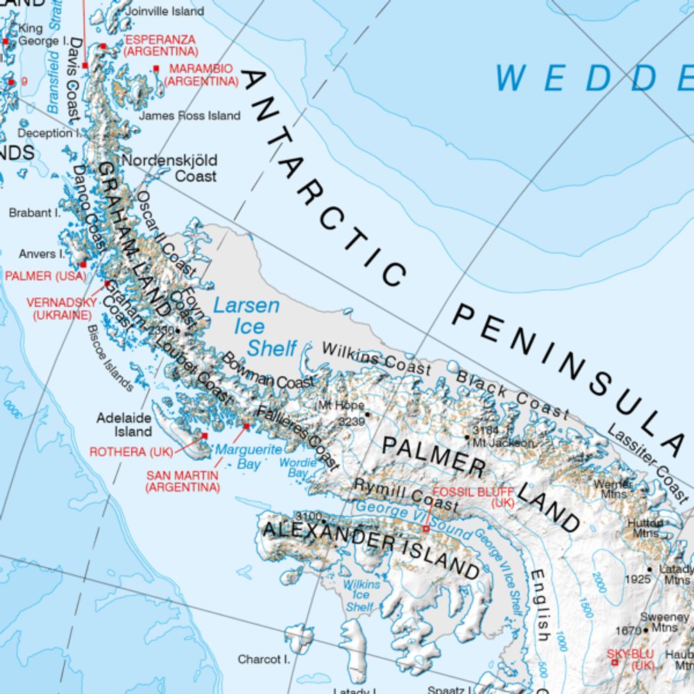
The Mapping and Geographic Information Centre (MAGIC) provides geospatial information, expertise, and services to the British Antarctic Survey (@bas.ac.uk) and wider UK activity in the Polar Regions.
🗺️ Bring your collections, data, and research to life with geospatial storytelling
https://humap.me/
#GLAMA #DigitalHumanities #EdTech #CitizenScience #CitizenHumanities
Canada's national newspaper, but on Bluesky
Facilitating coordination, collaboration, and advocacy for California's geospatial community
Amanda Katz said this was the cool kids table.
We’re the national library of the UK.
Citizen of the World
🌎 🌍
Am: 🏳️🌈
My goal here is to follow photographers and like minded people.
I post near daily my photography from daily life and my travel adventures.
#travel #fishing #cycling #photography #gis #geospatial
#MAPS #cartographer
Esri Director - Environment, Conservation & Natural Resources Solutions
Born at 347.15 ppm.
Botany nerd.
Tree hugger.
Prairie lover.
Biogeography Fangirl.
Lover of bicycles, dogs, books and food.
TN->NC
צְבִי
-Mapping the world- Dr. in Physical Geography | environmental health - bioclimatology - geography. RC Researcher from 🇩🇪 at @mbgcsic.bsky.social @csic.es in 🇪🇸 #rstats #dataviz
Secretary of the @aeclim.org
📍Galicia
ℹ️ https://dominicroye.github.io
Data editor @NBCNews.com, @NBCguild.bsky.social strong, Oregonian born & raised, lives in NYC (Gowanus, Brooklyn). Formerly: New York Daily News, Denver Post, Medill.
Into dataviz, spreadsheets, accessibility, coding.
joemurph.76 on signal
joemurph.com
@data.ft.com Senior Visual Journalist. Mad about cartography, dataviz and F1! Check out my QGIS youtube channel at http://bit.ly/1MAR2Po
Follow me on Instagram
@stevendbernard
Operating under the auspices of the Geospatial Professional Network (GPN), GISCorps coordinates short-term, volunteer-based GIS services to communities in need worldwide.
https://linktr.ee/giscorps
Mapping+Excellence+Community
The BCS promotes the art & science of mapmaking and all aspects of cartography to a wide audience.
Winter Lecture 11th Dec
GeoFutures questionnaire during December
GeoFutures 25th March 2026
Archaeologist. Finding stories.
Maps & Data. Product Marketer at Esri
Previously: Maxar, National Geographic, University of Oregon, and City of San Francisco
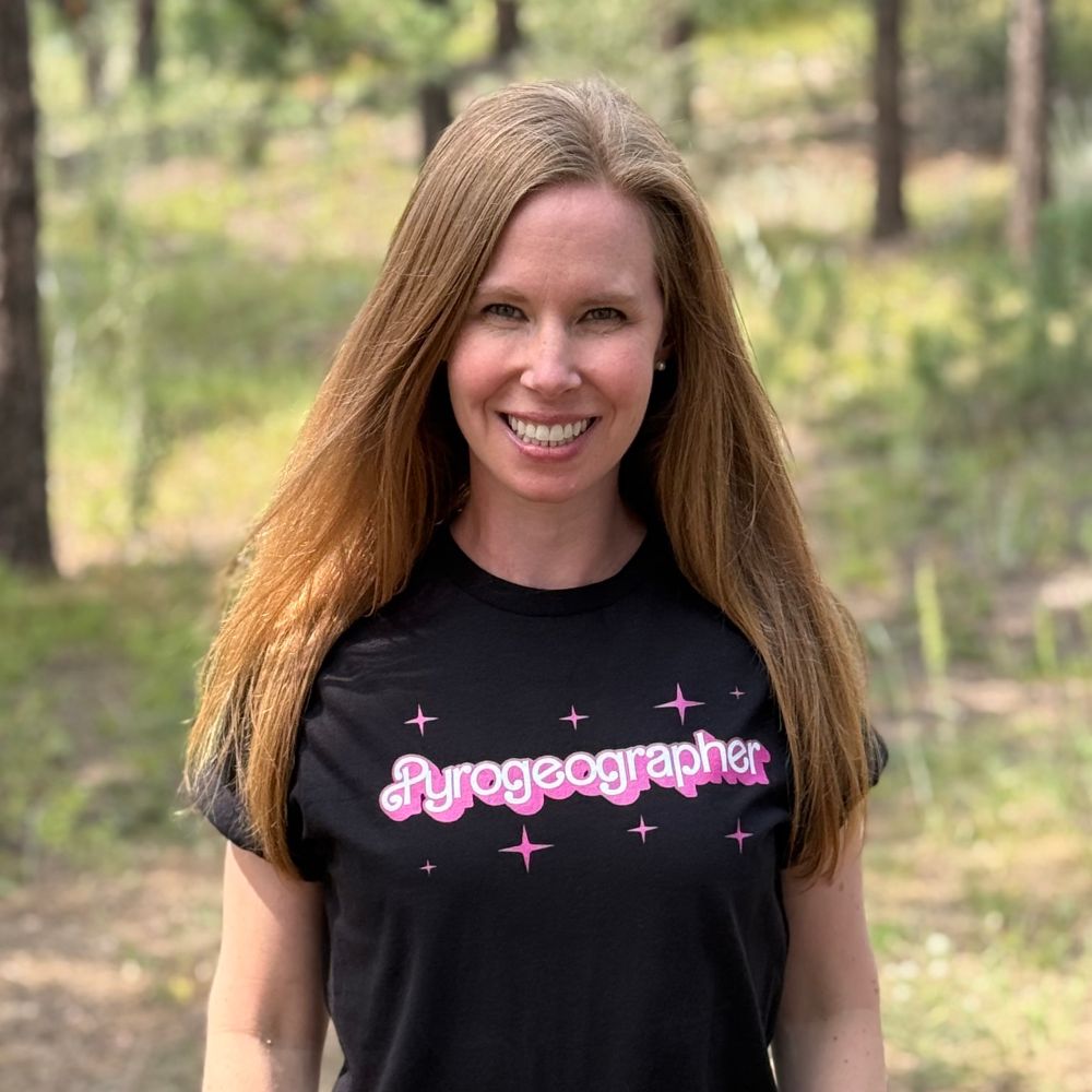
🔥🗺️ Pyrogeographer.
🛰️🛩️🔥 #RemoteSensing of #Wildfire.
❤️🚒 Passionate about finding ways to help emergency responders.
📣 #SciComm
👩💻 https://www.kristaleewest.com/
📍 Colorado, USA
Educational and informative world Maps 🗺️. We do not own any content posted. Dm for removal/credit.
𝐓𝐡𝐞 𝐞𝐲𝐞 𝐨𝐟 𝐭𝐡𝐞 𝐰𝐨𝐫𝐥𝐝.
🔎 Keep exploring → civixplorer.com
🗺️ Get your 3D relief map (𝟭𝟬% 𝗼𝗳𝗳) → www.3dmap.cc/coupon_civixplorer
ArcGIS Online product manager at Esri. Maps, Web GIS, enterprise-grade content management tools. I manage the ArcGIS Online Early Adopter Community. Can be found at events such as FedGIS, Dev & Tech Summit, and the Esri User Conference. Come say hi 👋
Innovative education, groundbreaking research, and essential solutions for climate and sustainability (climate.columbia.edu).
Capturing the zeitgeist of the #world through #maps. All original content maps.