My opinions are my own and not of my employer.
ISO-8601, Apache Arrow, and neovim enjoyer.
they/them
Devotee to #QGIS, #FOSS4G and beautiful Cartography. My imagination runs wild with ideas, that reality cannot cash. Love neo soul, funk, nu-disco, melancholic electronic and dance music. Be Kind.
🌏 https://osgeo-oceania.org | https://2025.foss4g.org/
Space & Geospatial Engineer / Lead of Center for Sustainability & Resilience at the European Space Policy Institute (ESPI) / Founder of geo4us.com
I advocate the use of space technology for underserved communities.
🔗 www.linkedin.com/in/jaravillanueva
Emmett!
30+ y/o GIS & boardgame nerd on the East Coast. they/them.
| Cartography. Ecology. Wildlife. Human Health. Conservation. |
Views and opinions are my own.
Open source geo developer (especially QGIS!)
I work with data at Relevant Research. I post about migration and sports.
Philadelphia, Pennsylvania, USA, Americas, Earth
Arsenal + Nuggets + Avs + Rockies + Summit
I helped build DetentionReports.com
https://adamjsawyer.com/about
he/him
I teach people to use R @rfortherestofus.com
I help municipalities and utility providers get a better return on their technology investments. I like paddling in whitewater and tinkering with an old CJ7. Located in East TN
Expert en coordenades... al braç
#GIS
Makes maps, carves wooden spoons, etc. he / him
Guilhem / gounux
GIS dev & trainings
Other stuff as well : music, memes, arts, nonsense
Remote Sensing Specialist at Agriculture & Agri-Food Canada (AAFC). Satellite mapping Canadian crops via #cropmap25 🌾🌽🛰️🗺️🍁
#RemoteSensing #EarthObservation #GeoSky | #Agriculture #CdnAg #AgSky | #Satellites #Landsat #Sentinel #SAR | #OpenData #OpenGov
Paleontologist, Graptolite Geek, R Programmer, creator of paleotree, Tabletop Roleplaying Game Nerd, Catcher of Pokémon, faculty senator. All comments are my trash opinion alone.
Large river ecologist, Director at the Illinois River Biological Station. My team and I specialize in large river ecology (long-term monitoring, restoration, and management). Lots of interests: otoliths, invasive species management, telemetry, rstats,...
Plant and geoscientist using drones and satellites to map spatio-temporal patterns | Working at the Center for Scalable Data Analytics and Artificial Intelligence (ScaDS.AI) and Dresden University | Previously at @iDiv, DE.
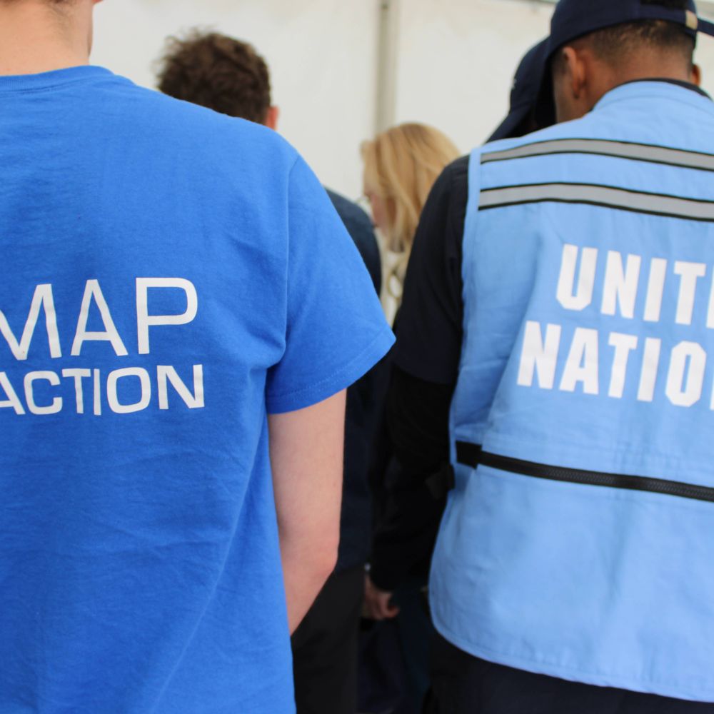
Official MapAction Bluesky Account. MapAction brings the power of professional mapping and geospatial analysis to humanitarian crises and preparedness. UK registered charity operating worldwide.
Follows don't equal endorsements.
Lunar Geologist
Drummer for A Troop of Echoes and Public Policy
Noisy bangers as D. Majestic and the Spectral Band
🏠 GIS @ Zillow | Advancing real estate geospatial mapping.
🌍 Enthusiast of spatial sciences and their applications in:
#GIS | #Cartography | #Meteorology | #Hydrology | #Ecology | #Nature🔬 Exploring the intersections of geospatial analysis, environment
I work with: #linux #mysql #php (sadly) #nodejs #docker #typescript #angular #ionic #capacitor #maplibre #graphhopper #android, #ios ... and more
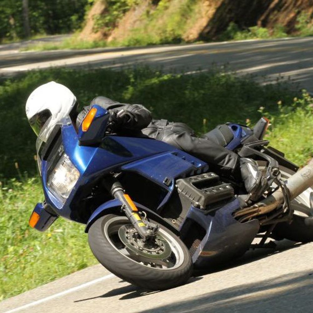
Motorcycles: #K100RS, #R1100S, #DR650SE
Sailboat: #SunOdyssey 44
I've also been known to write, reluctantly
Junior doctor by day. Data cruncher by night. Interested in everything, always learning and easily distracted by shiny objects. Born at 360ppm. 🇫🇷🇦🇺 Currently in Nhulunbuy, Australia 📌
i live in the bay area and work in fintech. stream of consciousness account. here for a fun time
We are the Professorship of Earth Observation for Ecosystem Management at the Technical University of Munich!
Our focus is on applying cutting edge remote sensing technologies to study forest ecosystems.
https://www.lss.ls.tum.de/en/eoem/
Oracle Developer Evangelist interested in Database, AI and Cloud with a focus on Micro Service development, Spring, Mobile and full stack.
"Innovation is a process of failing fairly regularly.”
Energy Resources, Development and Environment Lab (ERDELab) PI, @UBCforestry Assc Dean EDI. Energy, equity, justice, climate change, bioenergy. But also TTRPGs and photography (https://pixelfed.social/i/web/profile/499807930552574625). he/him.
Geography teacher. OSDSS. Exploring Grey-Bruce and beyond!
Geospatial and Earth Observation Researcher 🌎
OSGeo Nepal
Wildlife conservationist with a dedication for ecological monitoring of wildlife and wild lands. I have used a community-based approach to monitor and protect freshwater, coastal, tropical forest and savannahs habitats.
Urban Economist | Data Scientist | PhD candidate ETH Zurich | Mitglied GLP BS
Data and Graphics reporter at @theobserveruk.bsky.social. They/them
Message tips on signal @ bexsander.32
https://rj-sander.github.io/
Researching AI for Remote Sensing, Earth Observation and Climate @ National Center for Climate Research (Denmark) .: .
Researcher @ UC Davis Institute of the Environment studying biogeochemistry and logistics of nature-based carbon sequestration. Excited about digging holes, making maps, reducing waste, and beautiful Central Valley veggies. he/him
Environmental journalist. Founder of investigative journalism non-profit https://watershedinvestigations.com/
Bylines: @guardian @thetimes @bbc @SkyNews @itv
Ex: @TheENDSReport @PenguinUKBooks @independent
Rachel.salvidge@watershedinvestigations.com
B.S. Environmental Science/Conservation Biology
Volunteer Kelp Monitor and Scientific Diver - Island County, WA
Curious about Community/Network Ecology especially in its application to describe Autopoeisis at the habitat scale.
Dabble in photography
Ecologist and remote sensing scientist working at the National Research Council of Canada (NRC). RPAS and manned airborne expert focused on understanding how climate change affects ecosystems around the World. Passionate about conservation and biodiversity
#Geospatial enthusiast 🌍❤️🗺
IT girl (Genexus, .Net, R and SQL) | Teaching R to students with no programming background | Contributed to the Metadocencia Community and Training Teams | @rladiesrciactes co-organizer
Staff Engineer, open source fan, hacking on geospatial in my spare time. Lives in London
Data science, geomatics and GIS, remote sensing and 3D modelling.
Mapping+Excellence+Community
The BCS promotes the art & science of mapmaking and all aspects of cartography to a wide audience.
Winter Lecture 11th Dec
GeoFutures questionnaire during December
GeoFutures 25th March 2026
Geographer working on Canadian water science, data, policy, et cetera...
CPL Landman Interested in RStats, Quarto, Shiny, Geospatial, deutsche Sprache.
Assistant Professor in Human Geography and GIS. Université de Montréal @umontreal.ca.
Researcher on Housing and Social Inequalities.
maps, graphics, cities, etc.
website: https://jamaps.github.io/
github: https://github.com/jamaps
~9-5 M-F: https://schoolofcities.utoronto.ca/research-type/data-visualization/
maxing the pixels to glow
R, Python, GDAL, virtual Zarr, coordinate systems, southern ocean research
I sit and reflect about all that I've learned and all that I've seen
hypertidy.org
Paleoclimate, archaeology, human-environment interactions
Bioinformatics 🧬🖥️🧪
#PLOS Comp Biol Education Sect. Editor;
#DATABASE OUP Associate Editor;
#OpenScience #OpenAccess #OpenData;
friend of @jxtxfoundation.bsky.social,
@abinstitute.bsky.social
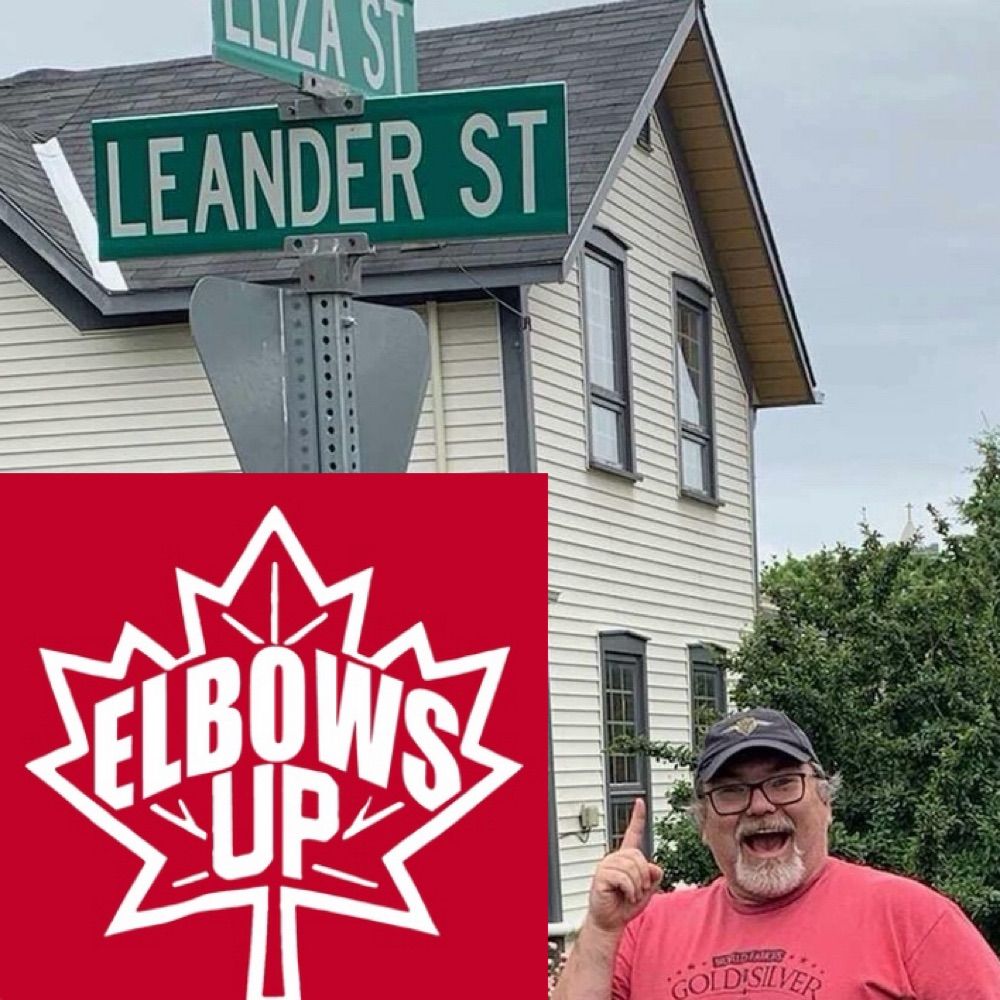
- I am 🇨🇦
Associate Professor of Geospatial Ecology, Uni. of Exeter, UK. Researching landscape function & management for societal benefit. (https://tess-lab.org). #SustainableLandscapes #RemoteSensing #LandscapeEcology #Vegetation #MachineLearning.
compute, deep learning, computer vision, climate, robotics, art, maybe even some pics | guillesanbri.com
Research scientist and software engineer in autonomous vehicles and control theory.
👉Sust.urbanism🤝DATA VIZ🤝Linguistics👈
Associate Professor of Spatial Data Science at McGill University. Place • Mobility • Privacy.
https://grantmckenzie.com
AICP, GISP, CFM, award-winning geospatial scientist, emergency manager, & planning commissioner. Iraq/Afghanistan combat veteran. Bronze star medal recipient.
Energy & Climate Geopolitics
Head of Political Strategy @350.org
Energy Co-Lead, International Climate Policy Hub.
Views = my own
Geo Employer & Hobbyist. Father of 4 (+3), husband of 1. Promoting Geospatial from Central Illinois. These Are My Words. #geography #Maps #GISP
Canadian 🇨🇦 geologist and photographer in Calgary AB. Feeder of 2 dogs 🐶, harnesser of fire 🔥. All photos I post are my own. If you want to chat, reply to my posts :) No trolls/bots/adult content! No dms!
www.johncodyphotography.ca
Geographer and geospatial technologist. Owner of Sand Hill Geographic and Board member of the American Geographical Society. KU PhD.
Data, Golf, Barbeque, & Coffee Nerd.
Using remote sensing for environmental conservation | Rangeland condition assessment | Adelaide, Australia
Assistant Professor for Geoinformatics - Spatial Data Science at Trier University, Germany. Earth Observation. Remote Sensing. Geoinformatics. Data Science. Open Science.
🗺 - geography and climate science nerd
📸🎞️ - digital and film photographer
🖖 - sci-fi fanatic (Star Trek, Halo, Alien)
🎮 - gaymer (Halo, Civ, Cities Skylines, etc…)
🧑🔧 - I build ‘puters for fun 🐧🪟
💅 - drag and queer art ❤️❤️
🏈🏀 - 🦬🦁
bio.site/tscshots
Explorer of the universe!
Regular posts of historical and current NASA "images of the day".
This account is not associated with NASA, but will always post genuine images with full attribution, sourced from www.nasa.gov/image-of-the-day
Managed by 🔴 @redshift.pics
Documenting 🌪️🌩️weather, OU Meteorologists & and an MPA: severe weather education & resilience
https://www.atmosphericchaos.com
Associate Curator @ Rumsey Map Center, Stanford Libraries. Former Lecturer @ UTK SIS, PgM Google X, & PM Exploratorium. Car free since 2007.
Fuzzy data matching, entity resolution, data science, data analytics
Wildfire ecology | Data-viz & sci comm dabbler | xc skiing whenever there's snow ❄️ cycling whenever there's not 🚲
MSc Data Science student. BSc Hons Zoology grad.
Interests: Ecology, rewilding, nature recovery, behaviour, communication, HORSES! 🐴, data, coding, ML, EDI&A 🏳️🌈. Ex tech SEO & analytics.
Kindness. Hope > hate 💚
AuDHD. #pwME. UK 🇬🇧
GIS - RS - Disaster Management - QGIS - Computer Geek - Consultant
Chartered Engineer, Sustainability, Building Services Engineer. Ex-Electrician. Also write Python, learner of AI, ML.
Geologist, backpacker, board game lover, mushroom forager, tide pool lurker, salamander and slime mold superfan.
I study granites and rhyolites to understand how magma is stored in Earth’s crust 🌎🌋
Currently a postdoc working on Mono Basin eruptions 🔎🪨🤘🏼
Empowering citizens to advocate for pollution pricing and climate-aligned finance. Building a liveable world since September 2010. Focus is our superpower.
canada.citizensclimatelobby.org
GIScience conference series #giscience2025.
The 13th International Conference on Geographic Information Science, Christchurch, New Zealand August 26-29 2025.
https://giscience2025.org
Geographer | Assoc. Prof. U of Iowa | President https://cartogis.org | GIScience | cartography | HCI | human mobility & migration | kinship networks | flow maps | classical guitar | chess | https://geo-social.com | https://flowmapper.org
Geologist at the geohazard•climate•policy nexus. Hazard + risk. GIS, lidar, landslides, debris flows, floods. Kentucky Colonel in New Mexico. He/him.
More: www.linkedin.com/in/billhaneberg & https://scholar.google.com/citations?user=0mCybjIAAAAJ&hl=en
I am autistic as fuck, and I will be god damned before I obey our new fascist masters! Put me in the concentration camps along with the homeless and the immigrants here legally because they were born here. Born a feminist; writer; singer; loves sciences.
A data observatory for planet earth.
Juno is a free platform for collecting, collaborating, & reporting ecological data. Built by the creators of mWater and Solstice, the platform is used for water, sanitation, & global health for in 197 countries.
Critical cartographer. Geographer and architect. Associate Professor of Geography, Universitat de Girona
Data Viz/Design: http://evanoneil.studio
Mapping: http://beautifullyelevated.substack.com
Tennis Data Viz: http://sliceddata.substack.com
Astro PhD trying to move to Remote Sensing with Machine Learning and Radiative Transfer methods applicable to public datasets for a wide range of applications. Fan of public datasets :)
No fanatics & scammers e.g. buttcoiners, elonstans, putinists, pr0n🚫
Maps, houseboats, wine, Nordic noir, bird watching, and barge-spotting.
Air quality researcher at Airvoice.global
Mapbox consultant. Gardener. Grump.
https://hire.stevebennett.me
I paint the world with #rstats and teach you how to unleash your inner #map artist. Join my map adventures and tutorials now:
https://youtube.com/@milos-makes-maps
-Mapping the world- Dr. in Physical Geography | environmental health - bioclimatology - geography. RC Researcher from 🇩🇪 at @mbgcsic.bsky.social @csic.es in 🇪🇸 #rstats #dataviz
Secretary of the @aeclim.org
📍Galicia
ℹ️ https://dominicroye.github.io
R, data science, dataviz, maps, experimental design, raytracing. Developer of rayshader, rayrender, and the rayverse | PhD in Physics from Johns Hopkins | Penn
smitten with #rstats · associate prof · political economy · the #rayverse's number one fan
Researcher Ipea Brazil | Visiting prof @geo_uoft | PhD @TSUOxford | Structured procrastination on Cities, Urban mobility, Accessibility, Equity, Data science, R. About: www.urbandemographics.org/
Powerpoint by day, #ggplot2 by night. Here for dataviz and #rstats content and rants about football. 📊⚽️
Based in Cologne, Germany.
ASA Fellow; #rstats developer of graphical methods for categorical and multivariate data; #datavis history of data visualization; #historicaldatavis; Milestones project
Web: www.datavis.ca
GitHub: github.com/friendly
My name is Roman. Interests: Traveling, History, Economy, Languages (🇩🇪🇬🇧🇺🇲🇳🇱🇵🇱🇨🇳) and I make free map based geography learning games.
📍Frankfurt, Dortmund, Enschede, Cheltenham, Katowice, Jingdezhen
🗺️😎: https://geographyquiz.app/
Mapas para entender un poco mejor el mundo // Maps to understand the world a little better
📧 Newsletter (🇪🇸): newsletter.mapasmilhaud.com
📧 Newsletter (🇬🇧): www.cartographerstale.com
🗺 Mapas / maps: mapasmilhaud.com
Bikes (MTB, gravel), Travel, Spain, Higher Education, Geospatial Technology, International Development, Mediterranean food/lifestyle. (Don't forget to use your sarcasm filter) --alguna que otra cosa bilingüe
Yes it's me from twitter and @bigbookofr.com!
#dataBS #RStats
Science Data Visualizer | Seeking Next Opportunity | Former NASA Earth Observatory 🌎🛰🗺 | UCLA Alumni 🎓 | Award-Winning Cartographer 🧭 | 🎙️ President of Women in GIS
#rstats | #energy | #climate | #carbonmanagement | #sustainability | #ESG
https://karbonkounsel.org/
Dataviz designer, psychiatrist, PhD
https://karaman.is
Freelance Data Visualization Specialist and Data Analyst. 📊 Book nerd📚. Always seeking new insights and knowledge💡Available for Projects.
https://deepalikank.in/
'Peddler of Wheres,' job creator, Owner at The Map Center in Pawtucket RI- it's like a hip record store but for maps.
www.mapcenter.com
Cartographer, GIS specialist and educator
Linktr.ee/ecoandrewtrc