🏛️ Funded by the @ec.europa.eu and @ukri.org, ECHOES empowers cultural heritage professionals through the Cultural Heritage Cloud, driving digital innovation and collaboration.
Cascading Grants 2° Call: https://www.echoes-eccch.eu/second-call/
We are Swiss-made full-stack GeoNinjas.
We offer personalised opensource geodata solutions that deliver great value.
Support!? guaranteed, with SLA!
Geographer and Professor in Geoinformatics @unitartu, Head of the @LGeoinformatics Lab. Geospatial and open data enthusiast, foodie and coffee junkie :-)
A simple, declarative, reactive, and high performance data visualization microframework
- documentation : https://www.grapper.io/
- examples and playground: https://playground.grapper.io/
Father of twins, life enthusiastic, curious, interested in nature, environment, science, geo-stuff and open approach to knowledge.
GIS, Geo Data Science, GeoAI, LLMs & NLP
Democratizing Geodata & Tools
I paint the world with #rstats and teach you how to unleash your inner #map artist. Join my map adventures and tutorials now:
https://youtube.com/@milos-makes-maps
-Mapping the world- Dr. in Physical Geography | environmental health - bioclimatology - geography. RC Researcher from 🇩🇪 at @mbgcsic.bsky.social @csic.es in 🇪🇸 #rstats #dataviz
Secretary of the @aeclim.org
📍Galicia
ℹ️ https://dominicroye.github.io
R, data science, dataviz, maps, experimental design, raytracing. Developer of rayshader, rayrender, and the rayverse | PhD in Physics from Johns Hopkins | Penn
smitten with #rstats · associate prof · political economy · the #rayverse's number one fan
Researcher Ipea Brazil | Visiting prof @geo_uoft | PhD @TSUOxford | Structured procrastination on Cities, Urban mobility, Accessibility, Equity, Data science, R. About: www.urbandemographics.org/
Powerpoint by day, #ggplot2 by night. Here for dataviz and #rstats content and rants about football. 📊⚽️
Based in Cologne, Germany.
ASA Fellow; #rstats developer of graphical methods for categorical and multivariate data; #datavis history of data visualization; #historicaldatavis; Milestones project
Web: www.datavis.ca
GitHub: github.com/friendly
My name is Roman. Interests: Traveling, History, Economy, Languages (🇩🇪🇬🇧🇺🇲🇳🇱🇵🇱🇨🇳) and I make free map based geography learning games.
📍Frankfurt, Dortmund, Enschede, Cheltenham, Katowice, Jingdezhen
🗺️😎: https://geographyquiz.app/
Mapas para entender un poco mejor el mundo // Maps to understand the world a little better
📧 Newsletter (🇪🇸): newsletter.mapasmilhaud.com
📧 Newsletter (🇬🇧): www.cartographerstale.com
🗺 Mapas / maps: mapasmilhaud.com
Bikes (MTB, gravel), Travel, Spain, Higher Education, Geospatial Technology, International Development, Mediterranean food/lifestyle. (Don't forget to use your sarcasm filter) --alguna que otra cosa bilingüe
Yes it's me from twitter and @bigbookofr.com!
#dataBS #RStats
Science Data Visualizer | Seeking Next Opportunity | Former NASA Earth Observatory 🌎🛰🗺 | UCLA Alumni 🎓 | Award-Winning Cartographer 🧭 | 🎙️ President of Women in GIS
#rstats | #energy | #climate | #carbonmanagement | #sustainability | #ESG
https://karbonkounsel.org/
Product Manager at Esri | Interests #GIS, #HealthGIS, #Maps, #DataViz
Dataviz designer, psychiatrist, PhD
https://karaman.is
Freelance Data Visualization Specialist and Data Analyst. 📊 Book nerd📚. Always seeking new insights and knowledge💡Available for Projects.
https://deepalikank.in/
'Peddler of Wheres,' job creator, Owner at The Map Center in Pawtucket RI- it's like a hip record store but for maps.
www.mapcenter.com
Cartographer, GIS specialist and educator
Linktr.ee/ecoandrewtrc
Data visualization designer
krisztinaszucs.com
Data analyst/scientist making data analysis software, #datavis, #datascience , etc, nature photography, some creativity and hobbyist personal complex medical research . ( Did I miss anything?... well, #mecfs ;)
miskaknapek.eu
Remote sensing of our living environment from space-borne to UAS/UAV, from the tropics to the Arctic -- at @uni-wuerzburg.de, Germany -- https://www.remote-sensing.org http://www.earth-observation.org - managed by Dr Martin Wegmann
Professor Emeritus of geography & environmental studies, Saint Mary's University, Canada.
Interested in mapping, urban planning, transportation, time use, Nova Scotia
#geography #location #maps #transportation #urban
Data Visualization & Creative Coding enthusiast. Ex-DellEMC, ex-Siemens. MSc, Electrical and Computer Engineering. 🐶Welsh Corgi ❤️🎼🌊📷
Blog: http://lbarqueira.github.io/
M. Sc in Water Resources💧 | Eng in Structures Construction, Civil Engineering Hydraulics 🏗️ | Water Allocation - Quality Modelling 🌡️ | Data Visualization ✨| GIS 🌐 | R 📊 | Python 🐍
Spatial Data Scientist, Doctoral Researcher #HumanMobility #geospatial @mpidr.bsky.social, @imprs-phds.bsky.social, @upf.edu #rspatial #rstats dev of #rstats github.com/rOpenSpain/spanishoddata 🌐: www.ekotov.pro datasci.social/@EgorKotov
Associate Professor @UTKnoxville | Amazon Scholar | Creator of #geemap & #leafmap | Talk about #Geospatial #GeoPython #DataViz #GIS #FOSS #EarthEngine
Researcher. Cities, urban morphology, human geography & spatial data science. Open source software developer. #python #cities #open_science
https://martinfleischmann.net
#Urbanismo, Política y Filosofía | Maestría en Planificación y Políticas Urbanas.
https://substack.com/@fernandomaidana
(Mis opiniones son personales)
Cartography and graphics @postgraphics.bsky.social | Big ol' fan of @wfmu.bsky.social
https://moriartymaps.com/
Data visualisation designer at BBC News focusing on satellite data, climate change and cartography | previously at @esa.int | Co-founder of @chartle.cc - A daily chart game
Understanding and supporting people in their spatial interactions through computational #spatial #data #science #giscience #melbourne 🛶🚵♂️🥾🏊♂️🐕
@unimelb, own views. support 🇺🇦 www.tomko.org
Forest Fire Research Scientist with Canadian Forest Service 🔥🌲🌳 and the WildFireSat mission 🚀🛰 📡 | Advancing how we use satellites to monitor fires and their impacts | Woman in Remote Sensing | Mother in Science 💻👩💻👩🔬🧪 | she/hers | celiac | 📚🎵🎶👟☕️ | 🇨🇦🇺🇸
Prof Geographic Information Science at the University of Liverpool; Author of Urban Analytics (https://amzn.to/2l5txth) https://mapstodon.space/@alexsingleton
• passionate about #maps, #geodata & #ddj
• (urban) data analytics @ubilabs
• data journalism @spiegel.de
• Hamburg, Germany
🇬🇧 Dutch designer/video maker/animator. #maps #flags #boardgames #infographics
💚 Groningen – he/him 🗺 🇪🇺
Get my maps: studiolegenda.com
🇪🇺🇳🇱 NVvV #vlaggenkunde
🔹 = autopost
Obsessed with data graphics. I design high‑stakes charts.
Founder, Visionary Press • CHARTOGRAPHY weekly
Talks • workshops • consulting → infowetrust.com
Research Faculty at Michigan State University. Geodesy, Tectonics, and Glaciers. All opinions my own.
Collaborative Innovation @IGNFrance.bsky.social 🇫🇷 | Chair of Commission 4 @EuroSDR 🇪🇺 | 🌍🗺️🛰️ #Innovation #OpenData #DataValuation #Commons | ♀️=♂️
data scientist in toronto / maps and dataviz / almost useless trivia knowledge
https://ivabrunec.github.io/
Information Management Officer at UNHCR specialized in #DataViz and #maps. Love #rstats stuff, especially making charts with #ggplot2.
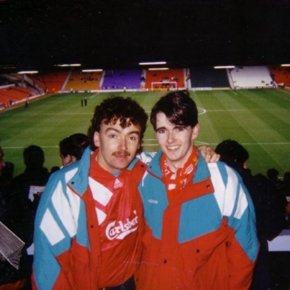
#LFC fan, from Plymouth, lives in Corfe Mullen Dorset, husband, father, grandad, brother, son.
Climate scientist at DMI, Greenland, Antarctica, polar regions in general.
Dipping a toe in yet another social media site. Mostly on mastodon though @ruth_mottram@fediscience.org
Blogging at sternaparadisaea.net
I like collating data,
and getting thoughts in the brain.
All for Public data, Aotearoa New Zealand, and informed communities. #openData #NewZealand #Aotearoa #rstats. He/him.
He tangata tiriti ahau
Pro Genealogist & Scientist at www.khronicle.co.uk, #Genealogy Expert for Time Team. Oxford D.Phil.(SysBio), Fiend for #maps & #research methods. Big hair, big heels, weakness for cake.She/her.
Blog: www.parchmentrustler.com
Demographics | Geospatial | Data Science | Open Source
Climate Scientist -Earth -Water -Data.
PhD, PG
https://scholar.google.co.uk/citations?hl=en&pli=1&user=aEgv38gAAAAJ
Associate Prof of Geography | @UofSouthAlabama | Climate Change | Agriculture | Viticulture/Wine | GIS | Certified Spin 🚴 Instructor | Tacos | Not necessarily in that order
Social Work Professor | Data Viz & Map Designer | Tableau Visionary & Ambassador | husband/father | perpetual student | he/him/his | no AI used
Researcher @CIBIO_InBIO interested in #climatechange #biodiversity #spatialecology #remotesensing
Strong addiction to maps🤷♂️
William C. Wonders Map Collection, University of Alberta Library. Curation by Wyman Laliberté (he/him) (settler on Treaty 6 land).
WCW Map Collection on Internet Archive
https://archive.org/details/wcw
#spatial #maps #cartography #gis #qgis
UW Madison Geography, opinions are mine. Geomorphology, soils, dunes, loess, in the Midwest, Great Plains, northern China. He/him. Living on Ho-Chunk lands.
Computational geographer. Associate Professor at AMU, Poznan, Poland. Co-author of http://r.geocompx.org, http://py.geocompx.org, and http://tmap.geocompx.org books. #rstats #rspatial #geocompx
https://jakubnowosad.com/
Cartography • Geo-visualization • Geo-Scientist • Esri
Keynote speaker • Rock climber • ITMF • behance.net/sarahbellmaps
TUDelft BK-Urbanism community of practice that aims to empower students, researchers, and practitioners to use open-source software and open science practices to answer urban questions effectively and with confidence | #rstats #urbanism | rbanism.org
NFLDer in the UK. Lecturer in GIS and Spatial Analysis - U. Sheffield. Digital media/ regional graphics editor for ‘Regional Studies, Regional Science’. Urban econ, data, spatial stats & open science 🌎🗺️
👋🏻 I'm Kate ᵉᵃᵗᵉʳ ᵒᶠ ᵖᵒᵗᵃᵗᵒᵉˢ ᵃⁿᵈ ᵐᵃᵏᵉʳ ᵒᶠ ᵐᵃᵖˢ
🌐 I make #geospatial & #GIS (more) fun by sharing #mappymeme s & #maptastic themes. #GISchat. ᵛᶦᵉʷˢᵐᶦⁿᵉ
http://linktr.ee/pokateo_maps
Data visualization consultant at the Development Data Group of the World Bank
www.maartenlambrechts.com
Data Visualization. Ex-Planet & NASA Earth Observatory. Blue Marble, Earth at Night, color, cartography, occasionally skewed views of Earth. Looking for a job.
Tropical geek & hobbit
🇧🇷 data journalist | #rstats #rspatial #ddj #data | 🎲 📊 🗺️
I cover democracy, corruption, environmental crime and inequality.
📍São Paulo / Brasília
🏆2023 SEJ & OPC |🥈Pulitzer finalist
https://linktr.ee/ceciliadolago
🛰️🌲🔥 Researcher at Oregon State University / Earth observation and fire / open source geospatial / Python / Earth Engine
aazuspan.dev
Map nerd and data analyst.
https://www.mel-likes-maps.com/
Product Owner Digital Service GIS / Senior Architect GIS & software at SBB (Swiss Federal Railways) with love for beautiful maps, vintage computers & most importantly the demoscene (Unlock/Padua^Vantage). Founding member & president of @echtzeitkultur
#AllDataIsSpatial #DataIsPlural #KiwiInColorado | Spatial Data Scientist / Researcher | Sharing (Mainly) GIS, Spatial and Geology 'Stuff' | Personal Account, Not Specifically Related To My Employer
GIS Faculty, Centre of Geographic Sciences (COGS); Fellow, Royal Canadian Geographical Society; co-Director, Esri Canada Centre of Excellence (COGS). My posts
Just getting started on bluesky
Astronaut photos-of-Earth maps: https://isspix.com/MapTourHowTo
Editor at Environment & Planning, B and expat at the University of Bristol. Code with pysal and geopandas. Stats, Cities, and People. Catch up with me at http://ljwolf.org
Geography/GIS educator FRCGS FRGS. Climate SLR. #Dal #SMU #QE2PlatMedal. Semple GeogEd Award. Apoplectic-adorable. Shot 67. Book addict (socialtechfuture) CBCIdeas. Sci-fi. Old movies. WHU COYI. Parkinsons sucks | michaeljfox.org | Mi’kma’ki (Nova Scotia)
Geospatial problems solver.
All my stuff is posted using farm-to-table WiFi, free-range 5G or locally-sourced Ethernet.
Specialization is for insects.
nimbi.es
Associate Professor. GIScience, Movement Analytics and hiking/walking photos.
Adorable little academic journal. We publish on geographical methods, spatial and urban analytics + innovative applications. Editor: @rsfrankl.bsky.social
https://onlinelibrary.wiley.com/journal/15384632
Building https://openfreemap.org and http://maphub.net
Writing on http://blog.hyperknot.com
Loves paragliding
Cartography is my passion & profession. Author of CARTOGRAPHY. & THEMATIC MAPPING. Maps+drums+beer+snowboards+footy+politics+sarcasm. 🇬🇧 in 🇺🇸 Views mine. links.esri.com/mappyhour
Picterra provides sustainability leaders with a Mission Control for Environmental Intelligence.
Our GeoAI platform transforms satellite and drone imagery into continuous, verifiable insights across land, supply chains, and ecosystems.
➡️ picterra.ai
geospatial data | project management
Maker of maps. Geography/GIS/Cartography professor. Occasional landscape photographer. Not the English footballer but am available for autographs.
🗺🇳🇿🇨🇦🏔 NZ-based cartographer, actually now Canada-based. Blender, QGIS, ArcGIS Pro, Illustrator. Partial to a good mountain.
southarrowmaps.co.nz
Climate data
Politics
Drone imagery.
InSAR
#climate #drone #geo #brazil #oil #polynesiancanoe #vaa #canoe
🇧🇷
MAGAts are not welcomed here.
Journaliste - Enquête, traitement de données, analyse spatiale et cartographie - Nantes
(Datajournalism, geography & map design)
https://leplan.studio
Academic: Professor at RMIT University, GIScience, spatial algorithms, AI, and databases, ontologies http://gkl.rmit.melbourne
Author: GIS 3e http://gisacp.duckham.org
Me: gender equity, wheelchair user, food, new music
putting R in production @ricochet.rs
doing spatial stats @ Esri
blog: josiah.rs
Research ecologist. Author of the {elevatr} #rstats package. Still a tired parent. Raised in KC! Opinions and posts here are all my own. he/him.
#lakes #limnology #rstats #ecology #openscience #geospatial #datascience
Climate data scientist @metoffice specialising in generating interactive websites and bespoke #dataviz. #climate #maps #GIS #mapping #Rstats
Views are my own
California Beach Biogeography & Geomorphology, Geospatial Data Science, Cartography, Open Source, UC Davis Library, and definitely some cats.
OSGeo - FOSS4G - #gischat - #maptimeDavis
Coastal Earth Observation Scientist from Canberra, Australia. Using satellite remote sensing 🛰️, open-source geospatial 🔓🗺️, Python + R 🧑💻 and dataviz 🎨 to map the earth through space + time... 🌏
Geospatial Intelligence & analytics professional | International Security & Defence | Retired basketball nerd
🇳🇿 🗺️ 🛰️ 🏀 📊 👨💻 🌏 🥝
stay at home data scientist—engineer, hacker, baller—reading & talkin' about politics, open source, technology
currently working on maps, energy and architecture stuff
GIS | Geospatial health | Spatial epidemiology |
| Based @itmantwerp.bsky.social | Funded by @fwovlaanderen.bsky.social | Visiting Scientist @ KEMRI-Wellcome Trust Research Programme | https://www.petermacharia.com/
I like maps, GIS, data visualization, graphic design, hiking, writing, and hanging out in nature. I wrote a book, GIS for Dummies (2nd Edition).
Official Bsky Account for WomenInGIS.org
Chercheure/Researcher - afropéenne
#géographie #cartographie #critique #flowmaps
Univ. Gustave Eiffel
associée UMR Géographie-cites.
enseigne Univ. Panthéon Sorbonne Paris1 & EHESS
https://cv.hal.science/francoise-bahoken
scientist, riverscape research, river enthusiast, big family business man
Front-end cartographer. Research Engineer in Geographic Information Science at CNRS & UAR RIATE. Author of Mad Maps (2019) and Practical Handbook of Thematic Cartography (2020). Observablehq ambassador.
See https://neocartocnrs.observablehq.cloud/cv/